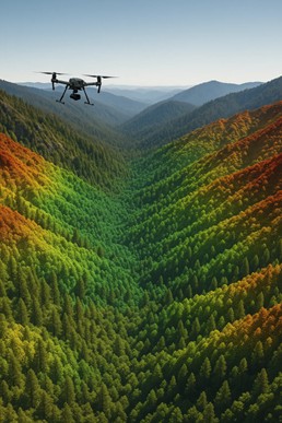
Rethinking Forestry in a Changing Climate
Forests are carrying more weight today than ever before.
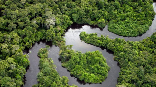
They’re no longer viewed simply as timber resources; they’re carbon banks, biodiversity strongholds, and climate stabilizers. And whether you’re looking at the dense, layered canopy of the Amazon rainforest or the rugged conifer stands of British Columbia, one truth is the same everywhere: the world needs wood, but it also needs intact, functioning forests.
That’s where the challenge lies.
Traditional logging methods were built for production, not precision. They rely heavily on ground crews, canopy-level imagery, and selective sampling, all of which leave forest managers with critical blind spots, especially under dense tropical cover.
But sustainable forestry has evolved. Today, the most responsible operators are asking a new question: How do we remove timber while protecting the forest’s ability to regenerate, store carbon, and stay ecologically healthy?
The answer comes from the sky.
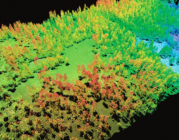
Modern LiDAR technology (Light Detection and Ranging) gives forest managers something they’ve never had before, a precise 3D look at the entire forest structure, from canopy to understory to terrain. It reveals slopes, soil conditions, hidden skid trails, micro-habitats, and standing biomass with a level of accuracy that ground surveys or satellite imagery can’t match.
Research published in Carbon Balance and Management and large-scale datasets from Amazon airborne campaigns show that LiDAR can accurately map vertical forest structure, ground elevation, and above-ground carbon stocks even under dense tropical canopy, something traditional optical methods simply cannot do. You can see one example of this work here: https://cbmjournal.biomedcentral.com/articles/10.1186/s13021-015-0013-x.
And for companies committed to ESG goals, certification standards, and transparent supply chains, LiDAR offers another advantage: accountability. It creates auditable, high-resolution datasets that document forest condition before, during, and after harvest, supporting certifications like FSC, PEFC, and REDD+ as well as environmental reporting.
Whether you’re working in the Amazon, Southeast Asia, or the temperate forests of Canada, LiDAR helps you plan smarter harvests, design lower-impact roads, minimize disturbance, and track regeneration with scientific accuracy.
This blog will show you exactly how. And if you’re ready to start strengthening your own forestry workflows, our team at Eagle Mapping specializes in LiDAR solutions tailored to sustainable harvesting, biomass modelling, road planning, and long-term monitoring.
What “Sustainable Logging” Really Means
Before we talk about how LiDAR transforms forestry, it’s important to get one thing straight:
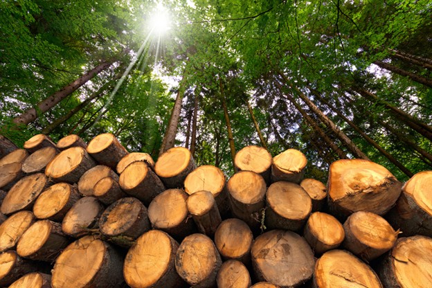
Sustainable logging isn’t about cutting less; it’s about cutting smarter.
When done correctly, sustainable forestry allows you to harvest timber while protecting the forest’s long-term ability to regenerate, store carbon, support wildlife, and provide ecosystem services. It’s a shift from “extract and move on” to “manage, monitor, and maintain.”
Most sustainable operations today follow principles from Sustainable Forest Management (SFM) or Reduced-Impact Logging (RIL), frameworks practiced across the Amazon, Southeast Asia, and temperate regions like British Columbia. According to the FAO, these approaches aim to preserve forest health, resilience, and biodiversity while still enabling economically viable timber production.
But here’s the problem: traditional methods miss too much.
Conventional forestry relies heavily on:
- Ground surveys, which are slow, labour-intensive, and cover only small sample plots.
- Satellite imagery, which can only see the canopy (and often misses understory damage or ground disturbance).
- Manual measurements, which introduce bias and require time-consuming revisits.
- Rough terrain estimates, which can lead to poorly placed roads and unnecessary disturbance.
In tropical forests, especially the Amazon, these limitations become even bigger:
You can have dense canopy hiding damage, unstable slopes, wet soils, and microhabitats that are invisible from above. A road placed just a few metres off optimal alignment can trigger erosion or fragment wildlife habitat.
This is where LiDAR changes the entire equation.
LiDAR creates a complete 3D model of the forest, not just the top layer. It reveals:
- True canopy height and density
- Understory vegetation
- Ground elevation and soil conditions
- Sensitive areas like wetlands or steep slopes
- Standing biomass and carbon content
- Existing skid trails or disturbance zones
Studies in Carbon Balance and Management and MDPI Forests show that LiDAR provides far higher accuracy than traditional methods for estimating biomass, mapping forest structure, detecting disturbance, and supporting low-impact harvest planning.
For example, LiDAR-based biomass modelling has been shown to outperform optical imagery in complex tropical forests, while Amazon-based research demonstrates that LiDAR can identify skid trails, landings, and canopy gaps with over 90 percent accuracy.
In short:
You can’t manage what you can’t see and LiDAR lets you see everything.
That’s why progressive forest managers from Brazil to Canada are using LiDAR as the backbone of modern sustainable logging programs. It gives them better data, better planning, and a better way to balance economic value with long-term ecological health.
If you want to use LiDAR to strengthen your own sustainable forestry operations, Eagle Mapping offers full-service workflows tailored to planning, biomass modeling, road design, and environmental compliance: Explore our forestry LiDAR services
What LiDAR Reveals That Traditional Methods Can’t
If you’ve worked in forestry long enough, you know the biggest challenge isn’t harvesting trees; it’s understanding the forest before you touch it. And the truth is, traditional survey tools can only show you a fraction of what’s really happening beneath the canopy.
LiDAR changes that.
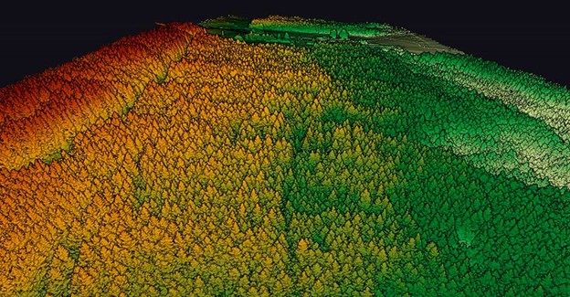
Instead of giving you a flat, partial view of the forest, LiDAR builds a full 3D model of everything from the highest canopy crowns to the forest floor. That’s why researchers at NASA and the Carnegie Airborne Observatory have used LiDAR extensively to map Amazonian forests; it captures detail no other remote sensing tool can match.
Here’s what LiDAR uncovers:
• True canopy height and structure
Satellite imagery might show you canopy cover, but LiDAR shows you vertical complexity, including canopy gaps, emergent trees, dense crowns, and regrowth patterns.
This is critical for biodiversity assessments and selective logging.
• Understory vegetation layers
In tropical forests, 70–80% of ecological activity happens under the canopy.
LiDAR penetrates dense vegetation, giving you accurate measurements of understory density, regeneration, and habitat structure, something traditional imagery simply cannot detect.
• Ground elevation beneath dense cover
Airborne LiDAR sends thousands of laser pulses to the forest floor and calculates their return, making it possible to generate bare-earth Digital Terrain Models even in thick rainforest.
This is invaluable for road planning, slope assessment, and soil protection.
• Biomass and carbon-stock estimates
LiDAR doesn’t just make biomass maps look prettier; it makes them more accurate and more useful. Studies in Carbon Balance and Management and MDPI Remote Sensing show that when you build biomass and carbon models from airborne LiDAR, you get tighter estimates and far less guesswork than if you rely on optical imagery or traditional methods alone. In complex forests, LiDAR simply does a better job of capturing real structure on the ground
• HYDROLOGY & WATERSHED INSIGHT
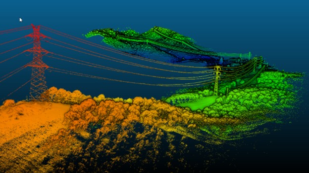
LiDAR-based terrain models help identify stream networks, drainage paths, flood-prone soils, and erosion risks, all essential for Reduced-Impact Logging (RIL) and long-term forest health.
• Hidden disturbance and microhabitat features
LiDAR can reveal old skid trails, abandoned logging roads, wildlife corridors, and areas of soil compaction that are invisible from above.
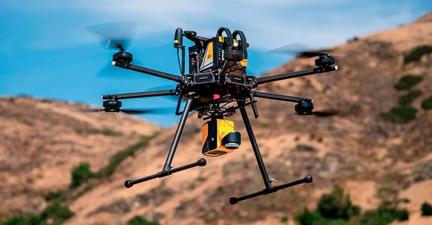
LiDAR gives you the full picture, and that’s exactly what sustainable forestry demands. When you’re ready to integrate LiDAR into your forest planning workflows, Eagle Mapping provides high-density airborne and UAV LiDAR solutions tailored to complex terrain: https://eaglemapping.com/services/
Pre-Harvest Applications: Planning Lower-Impact Harvests
Before a single tree is touched, LiDAR already does the heavy lifting. Pre-harvest planning is where LiDAR delivers some of its most powerful environmental and economic benefits, helping operators design harvests that protect soil, water, biodiversity, and long-term forest productivity.
Here’s how LiDAR supports low-impact planning:
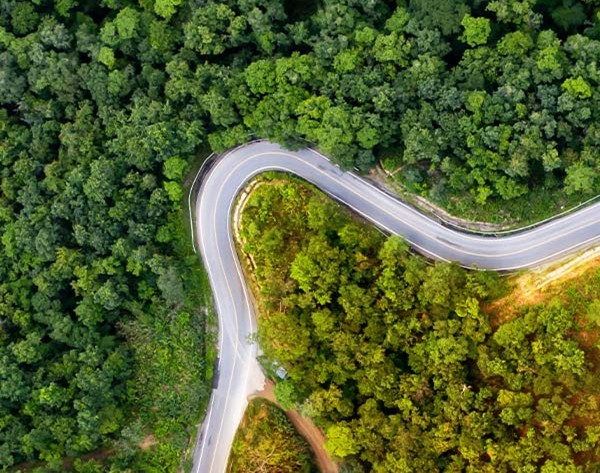
Terrain & Slope Analysis for Safer, Smarter Road Building
Logging roads and skid trails create the highest ecological impact in any harvest operation. Poorly placed roads lead to erosion, sedimentation, landslides, and long-lasting damage.
LiDAR-derived Digital Terrain Models (DTMs) show you:
- True ground elevation
- Slope angles
- Soil stability
- Erosion-prone areas
- Drainage patterns
This helps planners design access routes that:
- Avoid steep slopes
- Protect waterways
- Minimize cut-and-fill
- Reduce long-term maintenance costs
- Leave a much smaller footprint on the landscape
LiDAR is especially critical in the Amazon, where terrain complexity is often hidden under dense forest cover.
Identifying High-Value or Sensitive Areas
Not every hectare of forest is equally suitable for harvesting.
LiDAR helps identify:
- Old-growth or high-biodiversity zones
- Carbon-dense stands
- Wildlife corridors
- Wetlands or fragile soils
- Areas with high conservation value
This allows forest managers to protect what should be protected, and harvest only where the ecological impact is minimal.
Strategic Tree Selection & Stand Mapping
LiDAR supports selective logging by generating:
- Canopy height models
- Crown size estimates
- Stem density maps
- Biomass distribution
- Growth-stage classifications
Combined with field inventory, LiDAR helps operators choose the right trees, reduce waste, improve yield forecasting, and maintain long-term regeneration potential.

Compliance, Certification & ESG Reporting
Sustainability today isn’t just about being environmentally responsible. It’s about proving you’re responsible.
Governments, investors, certification bodies, and global buyers all want evidence that logging operations are minimizing impact, protecting ecosystems, and managing forests for the long term. LiDAR gives you that evidence with clarity you can’t get anywhere else.
Here’s how:
Meeting FSC, PEFC & National Forestry Standards
Certification programs like FSC and PEFC require transparent documentation of:
- Forest condition before harvest
- Protected areas and high conservation value zones
- Clear boundary mapping
- Evidence of reduced-impact harvesting
- Post-harvest regeneration and disturbance levels
LiDAR delivers exactly the type of spatial, measurable data auditors want. It provides forest managers with objective, repeatable measurements, making certification easier, faster, and more defensible.
Proving Low-Impact Logging with Hard Data
Reduced-Impact Logging (RIL) isn’t just a philosophy; it’s a measurable framework.
With LiDAR, you can document:
- Minimal skid trail density
- Restricted road footprint
- Controlled canopy gaps
- Protection of steep slopes and riparian zones
- Reduced soil disturbance
In the Amazon, researchers using LiDAR found that RIL operations left significantly smaller disturbance footprints compared to conventional logging, a claim easily verified by comparing pre- and post-harvest LiDAR scans.
Carbon Accounting & Climate Reporting
Major climate frameworks (REDD+, Verified Carbon Standard, and national ESG disclosure policies) rely on accurate biomass and carbon estimates.
LiDAR is the gold standard for this.
Studies in Carbon Balance and Management show that LiDAR-derived biomass estimates can be 40–60% more accurate than satellite imagery alone and this accuracy is critical for:
- Carbon credit programs
- Climate-risk disclosure
- Sustainable investment reporting
- Corporate ESG claims
Supply Chain Transparency
Timber buyers, especially in North America and the EU, are demanding proof that wood is coming from legally and sustainably managed forests.
LiDAR provides:
- Independent verification
- Spatially precise documentation
- Year-over-year transparency
- Visual evidence of responsible forestry
In other words: LiDAR helps you sell your timber with confidence, because you can prove your practices.
If you’re preparing for certification, ESG reporting, or carbon audits, Eagle Mapping’s forestry LiDAR services can support every stage:
https://eaglemapping.com/services/
From the Amazon to Canada: Why LiDAR Works Everywhere
Although sustainable forestry challenges differ dramatically between tropical rainforests and temperate or boreal forests, LiDAR solves problems across all forest types.
In the Amazon
- Dense canopy hides terrain, watercourses, and disturbance
- High biodiversity requires precise harvest planning
- Climate and ESG commitments demand rigorous carbon accounting
LiDAR cuts through the entire canopy, revealing ground elevation, understory structure, and biomass, exactly what Amazonian operators need for RIL and long-term sustainability.
In British Columbia & the Pacific Northwest
- Steep terrain
- Unstable slopes
- Complex drainage systems
- Critical habitats for endangered species
LiDAR helps map terrain, design low-impact access routes, and monitor hydrology, all essential for protecting ecosystems while maintaining forestry operations.
In Boreal Regions
- Large contiguous forests
- Fire recovery tracking
- Regeneration and carbon stock monitoring
- Identifying wetland systems beneath sparse canopy
LiDAR supports both harvest management and climate modelling, making it an essential tool for long-term planning.
Why It Works Everywhere
Because LiDAR doesn’t care whether it’s scanning:
- Dense rainforest
- Old-growth cedar
- Mixed pine
- Alpine treelines
- Boreal peatlands
Its laser pulses reach the ground, map the canopy, model the terrain, estimate biomass, and detect disturbance, consistently, repeatably, and with scientific accuracy.
That’s why LiDAR has become the backbone of sustainable forestry across continents.
The Eagle Mapping Advantage
If you’re serious about sustainable forestry, whether you’re operating in the Amazon, Western Canada, or anywhere in between, LiDAR is no longer optional. It’s the key to low-impact harvests, transparent ESG reporting, responsible road design, and long-term forest regeneration.
And that’s exactly where Eagle Mapping comes in.
Use LiDAR to meet your sustainability goals and minimize your environmental footprint.
Explore Eagle Mapping’s forestry services