sERVICES
At Eagle Mapping, we don’t just provide maps; we provide solutions. Our dedication to accuracy, innovation, and customer satisfaction is at the core of everything we do. We’re here to map the path to your future profits.
Acquisition
We offer exceptional LiDAR and Aerial Photography services. We have complete control over every stage of a project, thanks to our in-house sensors, aircraft, and data processing capabilities. This enables us to deliver the best possible results to our clients.
Processing
We are a highly experienced company in processing LiDAR data using the Terrasolid Suite. With years of expertise, we provide top-notch services to our clients.
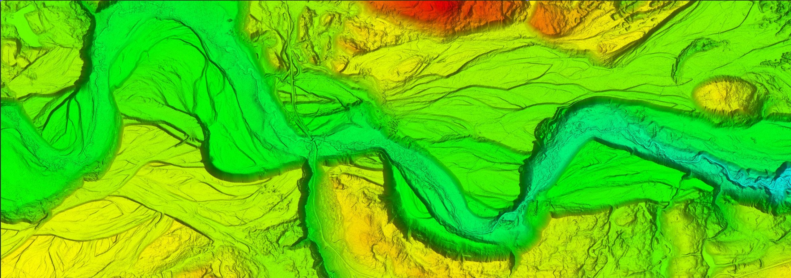
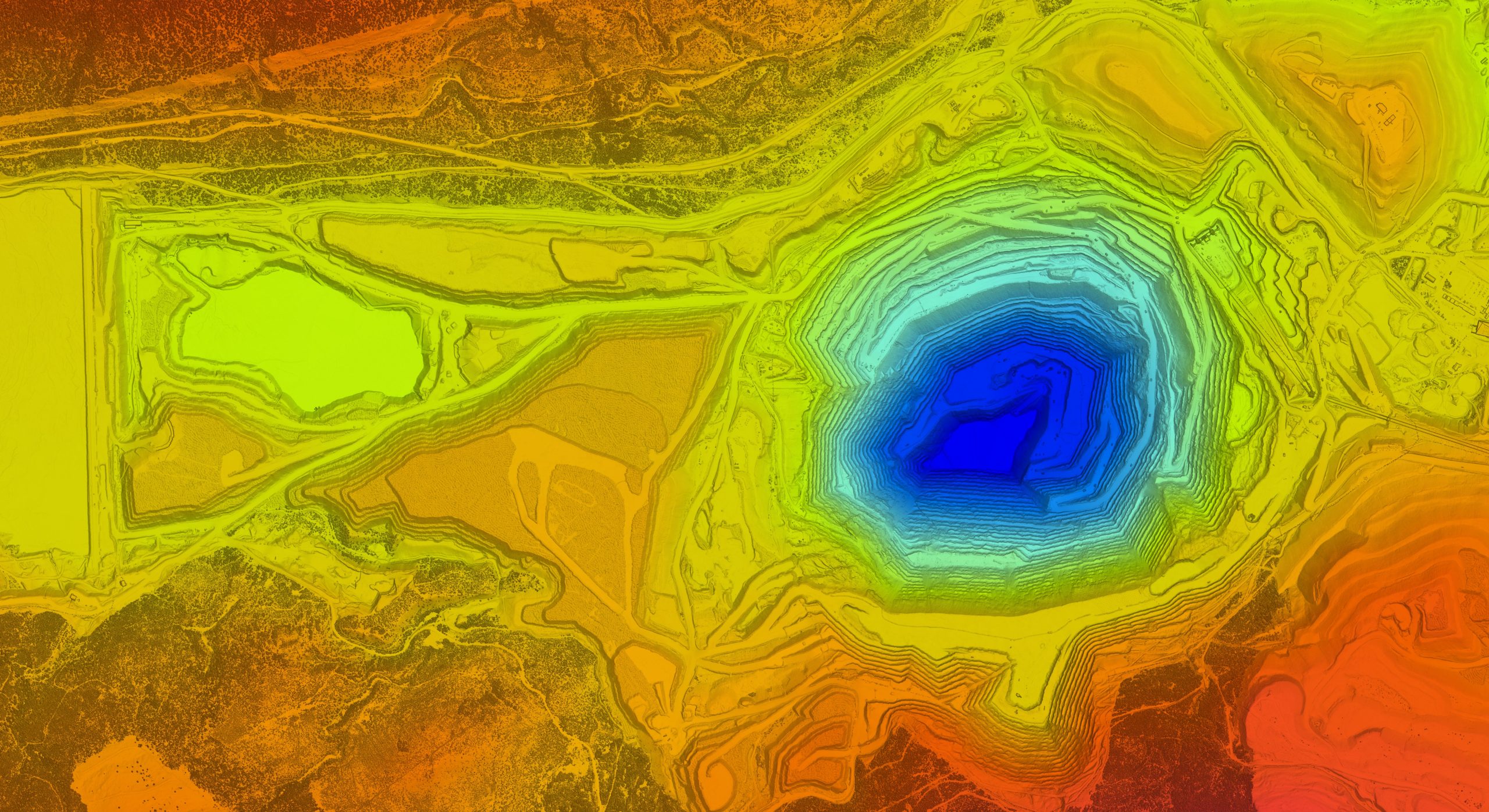
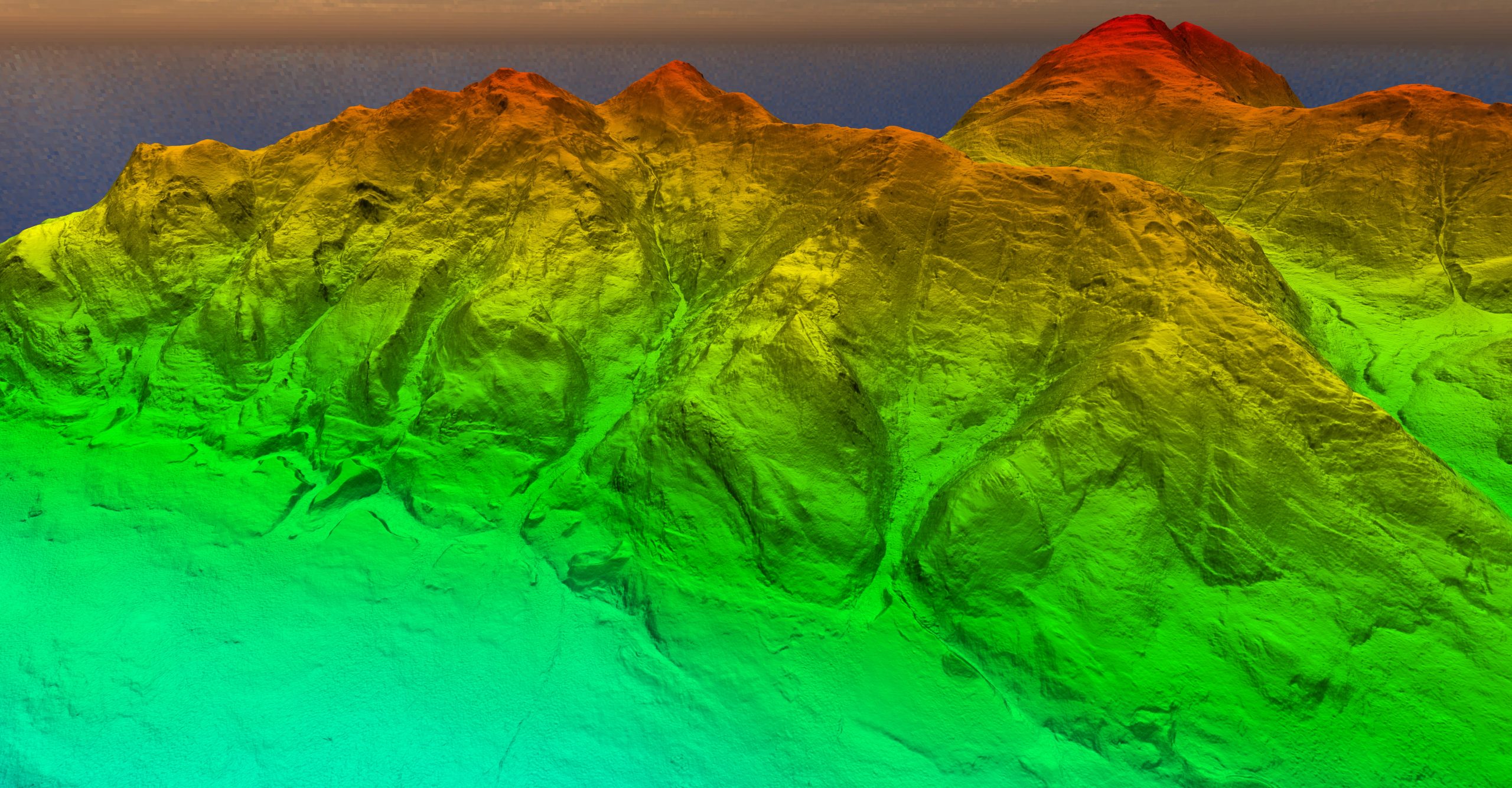
Deliverables
We provide a range of deliverables including orthophotos, bare earth models, contours, digital terrain models, hill shade models, slope models, intensity models, canopy height models, vegetation density models, and surface roughness maps.