Designing roads in mountainous terrain is not for the faint of heart.
Steep grades, unstable slopes, dense vegetation, narrow valleys, avalanche paths, every kilometre comes with new challenges. And if your terrain data is even slightly off, your alignment, drainage, and safety calculations will be off with it. That leads to blown budgets, unnecessary cut-and-fill, avoidable geohazards, and in the worst cases, roads that simply don’t work.
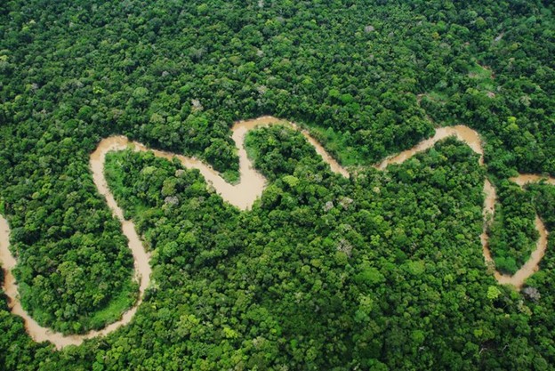
That’s why engineering firms in the Rockies, Andes, Sierra Nevada, and other high-relief regions are turning to LiDAR as their foundation for road design. LiDAR doesn’t just give you a top-down image; it gives you a high-resolution, 3D model of the terrain, even when the ground is hidden under dense tree cover or extreme elevation changes.
In mountainous terrain, accurate elevation data isn’t a “nice-to-have.” It’s the difference between a road that lasts 50 years and one that washes out every spring.
This guide will show you exactly why LiDAR has become the new standard for building reliable, safe, and cost-effective mountain roads, and why starting with the right terrain data is the smartest decision your engineering team can make.
The Challenge of Mountain Terrain: Why Accuracy Matters
Mountain environments are some of the most difficult places on earth to design and build transportation infrastructure. You aren’t dealing with flat ground; you’re dealing with constantly shifting variables:
- Steep slopes that demand precise grade control
- Dense forest canopy that blocks satellite visibility
- Cliffs, ravines, outcrops, and narrow benches
- Drainage networks that can appear or disappear seasonally
- Landslide- and rockfall-prone slopes
- Remote areas with limited access for field crews
Traditional surveying struggles here. Satellite imagery can’t see through trees. Drone photogrammetry becomes unreliable on steep slopes due to shadowing and occlusions. And sending ground crews into alpine terrain or deep valleys is slow, costly, and often dangerous.
This is where LiDAR stands apart.
Airborne LiDAR can penetrate dense canopy, capture millions of elevation points per second, and build a true bare-earth model of the terrain, not an approximation, not an interpretation, but an accurate 3D representation with centimetre-level precision.
Why does accuracy matter so much? Because in mountain road design:
- A 1% grade error can force a complete realignment.
- A misread slope can put your road on unstable ground.
- A missed drainage path can become a future washout.
- Underestimating a valley depth can add millions in bridge cost.
LiDAR eliminates those blind spots. It gives engineers a dataset they can trust, so they can make alignment, drainage, and safety decisions based on reality, not assumption.
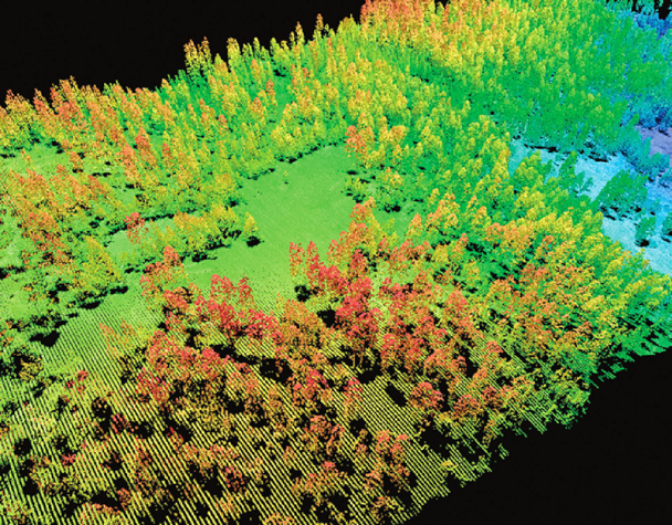
Bare-Earth Terrain Models: Seeing the Ground Through the Trees
If there’s one reason LiDAR has become the gold standard for mountain road design, it’s this:
LiDAR can see the ground even when you can’t.
In regions like the Rockies, Andes, Appalachians, or Pacific Northwest, dense forest canopy hides the true shape of the terrain. Traditional aerial photos only capture the treetops. Drone photogrammetry struggles with shadows, steep slopes, and occlusions. Ground crews can’t safely access every ridge, bench, or ravine.
LiDAR solves all of it.
Airborne LiDAR pulses penetrate the canopy and bounce back from the forest floor, allowing engineers to generate a bare-earth Digital Terrain Model (DTM) with centimeter-level accuracy, even in heavily forested or extremely steep areas.
With a high-quality DTM, your team can finally see what actually exists under the trees:
- Slope breaks and benches
- Valley bottoms and ravines
- Ridge lines and cliff edges
- Subtle elevation changes that affect grade
- Potential switchback locations
- Natural drainage channels
These details are almost impossible to map accurately with anything else and yet they matter more in mountainous terrain than anywhere else. Because if your terrain model is wrong, every design decision that comes after it will be wrong too.
LiDAR removes the guesswork and gives your engineers a foundation they can trust for alignment, safety analysis, and earthwork planning.
Optimizing Road Alignment in Steep Terrain
When you’re designing a road through the mountains, alignment is everything.
The wrong alignment can add millions to construction costs, cross unstable slopes, require unnecessary retaining walls, or force a grade that equipment can’t handle. The right alignment saves money, improves safety, and reduces long-term maintenance.
LiDAR is the tool engineers now rely on to get alignment right, especially in rugged terrain.
Here’s how LiDAR streamlines alignment design:
Test multiple alignment options quickly
LiDAR provides a high-density elevation dataset, making it easy to run multiple alignment scenarios in Civil 3D, InRoads, or GIS-based workflows.
Engineers can evaluate grade, curvature, cut/fill balance, and geotechnical risk, all before sending a single crew into the field.
Avoid unstable slopes
LiDAR-derived slope maps reveal:
- Over-steepened faces
- Historical slide scars
- Soil slip zones
- Rockfall source areas
- Loose talus or debris paths
This allows teams to route roads around hazardous terrain instead of discovering problems during construction.
Improve grade and curvature control
With precise terrain data:
- Switchbacks can be optimally placed
- Maximum grade constraints are easier to satisfy
- Horizontal curves meet safety standards
- Climbing lanes or passing lanes can be designed with precision
Minimize cut and fill
Accurate elevation data helps balance earthwork volumes, a huge cost factor in mountain road projects. Small errors in terrain can multiply into massive unplanned excavation costs.
Make real-world construction more feasible
LiDAR data helps identify:
- Safe equipment access routes
- Potential staging areas
- Areas requiring retaining structures
- Feasible bridge/culvert locations
All of this shortens the design cycle and reduces costly redesigns.
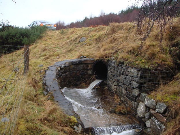
Drainage & Hydrological Modelling: Preventing Washouts and Road Failures
If there is one universal truth in mountain road design, it’s this: water will always find the weak point.
Highway hydraulics research and guidance from agencies like the FHWA Hydraulics team make it very clear that poor drainage design is one of the biggest long-term risks for road infrastructure.
Most mountain road failures aren’t caused by traffic, they’re caused by bad drainage. Undersized culverts, poorly placed ditches, ignored micro-drainage channels, hidden springs, all of these can undermine a road long before its expected lifespan.
LiDAR gives engineering teams a level of hydrological clarity you simply cannot get from satellite imagery or traditional topo surveys. Studies like Use of LiDAR-Based Elevation Data for Highway Drainage Analysis have shown that higher resolution LiDAR-based models significantly improve watershed delineation and drainage pattern mapping compared to standard elevation data.
Here’s why LiDAR is a game-changer for mountain drainage planning.
Reveals micro-drainage networks invisible from above
High-density LiDAR captures subtle slope changes and tiny channels that feed into larger drainage systems. These micro-channels are often impossible to see with the naked eye or from standard imagery, but become clear when you derive flow paths from a high-quality DEM or DTM. Resources that break down how elevation models support this kind of analysis, like UP42’s overview of digital elevation models, show how DEM-based flow routing exposes hidden drainage structure.
Supports precision watershed delineation
LiDAR-derived DTMs allow engineers to identify:
- Watershed boundaries
- Flow paths
- Convergence zones
- High-velocity runoff areas
This level of detail is critical for culvert placement, ditching, and erosion control. In fact, both the Federal Flood Mapping Guidelines Series and Canada’s Federal Airborne LiDAR Data Acquisition Guideline emphasize LiDAR as the preferred base data for hydrology and flood mapping because of its superior accuracy for terrain-driven water modelling.
Improves sizing for culverts and drainage structures
More accurate elevation means more accurate hydraulic modelling. When your DTM reflects real channel gradients and contributing areas instead of smoothed or generalized surfaces, your sizing for culverts, ditches, and cross drains is based on real-world conditions. Research on LiDAR-based drainage analysis has consistently found that higher-resolution LiDAR improves estimation of runoff and flow concentration, which directly reduces the risk of undersized culverts, one of the top causes of road washouts in steep terrain.
Identifies flood-prone and erosion-prone areas
LiDAR shows where runoff naturally concentrates and where slopes and channels combine to create high-erosion zones. This allows engineers to proactively reinforce or redesign vulnerable sections, rather than reacting after a failure event. Guidance documents for flood and hazard mapping increasingly recommend LiDAR-derived DEMs for exactly this reason.
Essential for debris-flow and post-fire hydrology
In regions where wildfires are common (BC Interior, Colorado, California), terrain and drainage patterns can change drastically after a burn. LiDAR helps predict debris-flow hazards, slope failures, and new drainage patterns created after fire and intense rainfall. Work on mapping and monitoring of landslides using LiDAR shows how repeated LiDAR surveys can track slope evolution, debris sources, and channel infill over time in steep mountain valleys.
Why this step matters:
Mountain roads fail where drainage is misunderstood. LiDAR lets engineers design with full visibility so they can protect infrastructure before the first storm hits.
If you want drainage modelling done right, Eagle Mapping provides hydrology-ready DTMs and watershed analysis layers:
Landslide, Rockfall & Geohazard Mapping
Engineering in mountainous terrain means dealing with risk and landslides are one of the biggest.
Traditional surveys cannot detect the subtle precursors to slope failure. Drone imagery can’t see the ground under forest cover. And relying on historical data is risky, because landforms change constantly due to weather, erosion, and seismic activity.
LiDAR gives engineers what they need most: a crystal-clear view of slope stability.
LiDAR supports geohazard analysis in several critical ways:
Detects unstable slopes with precision
LiDAR-derived slope and curvature maps help identify:
- Over-steepened slopes
- Soil slip zones
- Rotational slide areas
- Weathered rock faces
- Weak benches or talus deposits
Maps rockfall source zones and runout paths
LiDAR data reveals rockfall initiation points and natural fall lines, essential for designing mitigation structures like catch ditches, nets, or berms.
Highlights tension cracks and geomorphological features
High-resolution DTMs make it possible to see:
- Surface fractures
- Scarps
- Slumps
- Historical slide deposits
These tiny features can signal the early stages of slope failure.
Supports earthquake and heavy-rainfall risk modeling
In seismic regions (Andes, Pacific Northwest), LiDAR helps identify slopes that may fail during or after earthquakes.
In high-rainfall regions, the data pinpoints slopes susceptible to saturation and collapse.
Provides the baseline for long-term monitoring
Repeat LiDAR flights allow engineers to track slope movement over time, a powerful tool for risk mitigation and early intervention.
Why this step matters:
Roads built on unstable slopes will fail. LiDAR gives engineers the ability to spot hidden risks before construction begins, saving millions in repairs and keeping mountain corridors safe.
If you need geohazard-ready elevation data, Eagle Mapping has extensive experience in steep, complex terrain:

Cost Savings: Faster, Safer, More Complete Data Collection
In flat country, you can sometimes “get away” with weaker data. In the mountains, that luxury doesn’t exist. Every mistake in your terrain model gets magnified into a design problem, a construction problem, or a long-term maintenance problem.
LiDAR solves that at the root and it does it in a way that actually reduces total project cost.
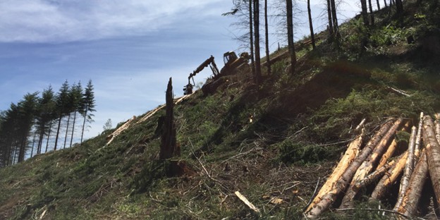
One Flight Instead of Weeks of Field Work
Traditional mountain surveying is slow and expensive.
You’re coordinating:
- Rope teams on steep slopes
- Helicopter drops into remote basins
- ATV or foot access in dense forest
- Multiple days or weeks of topo collection
With airborne LiDAR, you replace all of that with one well-planned flight.
A single mission can map:
- Hundreds of kilometres of proposed road corridor
- Remote valleys, benches, ridges, and cliff bands
- Forested slopes that ground crews simply cannot reach safely
What used to take several teams and several weeks can often be done in a single morning in the air.
Lower Risk, Lower Liability
Every hour your surveyors spend on unstable slopes, avalanche paths, or cliff edges increases project risk.
LiDAR keeps people out of those environments. Instead of sending crews into harm’s way, you’re flying above it, collecting millions of precise elevation points without putting boots on dangerous ground.
That means:
- Fewer rope systems and high-angle work
- Fewer helicopter landings in tight, risky terrain
- Less exposure to rockfall, slides, and wildlife
For engineering firms and infrastructure owners, that’s a direct reduction in liability.
Consistent Coverage From Start to Finish
Ground-based surveys in mountains often feel “patchy.” One crew covers km 0–5, another covers 5–10, and each stretch has its own subtle inconsistencies.
LiDAR gives you a single, continuous dataset:
- Same vertical accuracy from beginning to end
- Consistent point density along the entire corridor
- No missing gaps where access was too difficult
That consistency is golden when you start designing alignments, balancing cut and fill, and coordinating with geotechnical and hydrology teams.
Fewer Design Surprises and Construction Change Orders
Poor terrain data is one of the quietest, and most expensive, ways a project loses money.
It shows up later as:
- Unexpected earthwork volumes
- Misaligned grades or curves
- Misplaced culverts or structures
- Reactive redesigns under construction pressure
LiDAR drastically reduces those surprises. When your base surface is right, your design is right. And when your design is right, your construction phase runs smoother, with fewer change orders and less rework.
LiDAR isn’t an “extra”; it’s one of the simplest ways to de-risk mountain road projects, reduce field time, and protect your budget from costly surprises.

Engineering-Ready Deliverables
Collecting LiDAR is only half the story. The real value shows up when your design team opens the files and everything just works, no format issues, no guessing, no rebuilding surfaces from scratch.
That’s why engineering-ready deliverables matter.
The Core Terrain Products
For mountain road design, you’re typically working with a core stack of LiDAR-derived layers:
- Bare-Earth DTM
Your primary design surface for alignment, cut/fill analysis, slope stability, and drainage. This is the “truth” you build the road on. - DSM (Digital Surface Model)
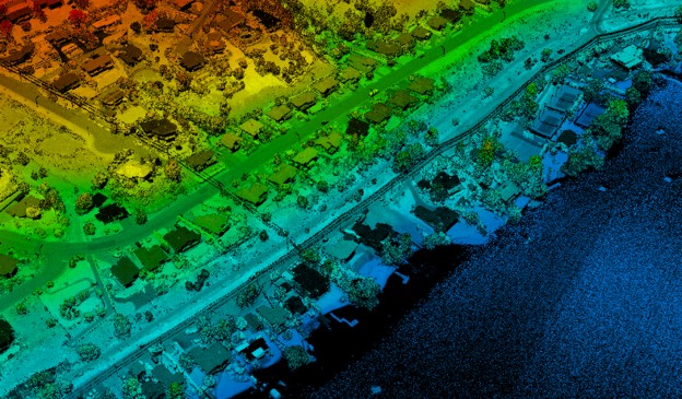
Useful for understanding what sits above the ground – vegetation, structures, and rough surface features. - Classified Point Cloud (LAS/LAZ)
Ground, low/mid/high vegetation, buildings, water, and more, each point tagged so engineers and analysts can filter and extract exactly what they need.
Design-Ready Layers for Real Mountain Work
Mountain projects are complex. The deliverables should make them easier, not harder.
Typical engineering-ready layers include:
- Contours at appropriate intervals (often 0.25 m, 0.5 m, or 1 m in steep terrain), generated directly from the DTM.
- Breaklines for water features, ridges, road edges, slope breaks, shorelines, and other critical edges that control how surfaces behave.
- Slope & Aspect rasters, which are invaluable for:
- switchback placementassessing stability
- evaluating sun/shade and icing risks
- Hydrology layers, including derived streams, flow paths, and catchments, ready to plug into drainage and flood models.
These are not “nice-to-have” layers in mountainous design; they’re the difference between guessing and knowing.
High-Density Data for Detailed Design
When you move from preliminary alignment to detailed design, retaining walls, avalanche sheds, complex intersections, or rockfall berms, the point density from LiDAR really starts to shine.
More points mean:
- Better definition of small benches and breaks
- Clearer rock faces and slope transitions
- More confidence in structure placement and sizing
Instead of approximating the ground, your designers are working from thousands of real elevation points in every critical area.
Delivered in the Formats Your Team Actually Uses
All of this only matters if the data drops cleanly into your existing software stack.
Typical formats include:
- GeoTIFF for DTM, DSM, slope, aspect, and hydrology rasters
- LAS / LAZ for point clouds
- SHP / file geodatabase / GeoPackage for GIS layers
- DWG / DXF for CAD-based design environments
So whether your teams are working in Civil 3D, MicroStation / InRoads, ArcGIS Pro, QGIS, HEC-RAS, or geotechnical packages like GeoStudio or Rocscience, the LiDAR data is ready to go on day one.
The goal isn’t just pretty elevation maps. The goal is to give your engineers a terrain model they can trust, and a set of deliverables that slot straight into their workflow.
Better Data Builds Better Roads, Especially in the Mountains
Mountain roads don’t forgive bad data. Every slope, every ridge, every drainage channel, every buried hazard matters, and those details rarely show themselves through traditional surveying, satellite imagery, or guesswork. LiDAR changes that by giving engineering teams a complete, high-resolution picture of the terrain before a single piece of equipment touches the ground.
With LiDAR, you’re not just improving a map. You’re improving every decision that follows: alignment, drainage, earthworks, slope stability, access planning, and long-term maintenance. It’s why infrastructure firms across the Rockies, Andes, Sierra Nevada, and beyond now treat LiDAR as the foundation of modern road design, not a luxury add-on.
As terrain gets more complex, the margin for error gets smaller, and LiDAR gives you the confidence to design with accuracy from day one.
Whether you’re planning a resource road, upgrading a mountain pass, evaluating geohazards, or preparing a full corridor study, Eagle Mapping provides the data, experience, and support you need to build infrastructure that lasts.
If you want terrain you can trust, start with LiDAR.