When it comes to forestry inventory, accuracy isn’t just a “nice to have.” It’s the difference between hitting your harvest targets or missing them by a mile. Between protecting your forest assets or unknowingly degrading them. Between meeting carbon reporting standards or failing an audit.
The problem?
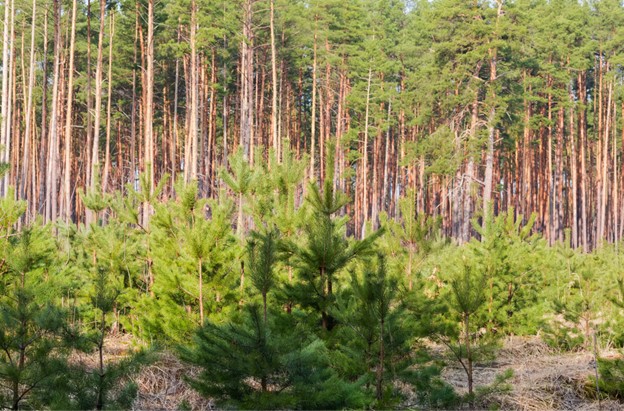
Traditional field plot surveys, the industry go-to for decades—are slow, expensive, and cover a shockingly small percentage of your land. According to the USDA Forest Service, most cover less than 1% of a forested area. That means your “plan” is built on extrapolations, not complete data.
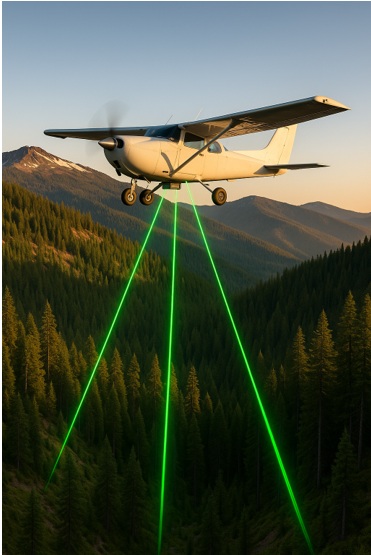
That’s where LiDAR (Light Detection and Ranging) flips the script.
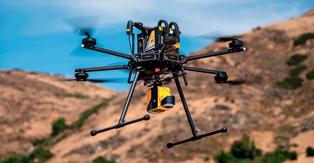
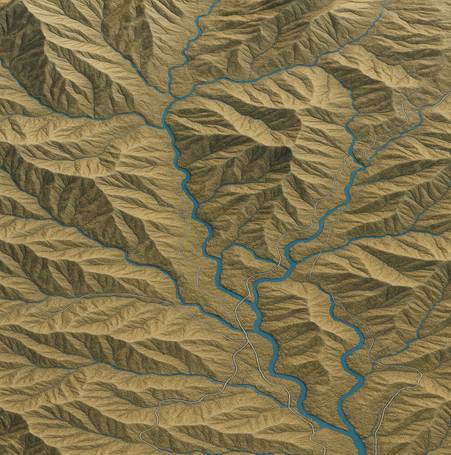
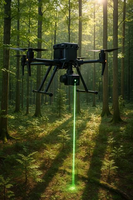
Using millions of laser pulses from an aircraft or drone, LiDAR gives you full-coverage, high-resolution 3D data—right through dense canopy. No guesswork. No blind spots. Just an accurate, data-rich view of every stand, slope, and stream in your forest.
As Dr. Nicholas Coops from the University of British Columbia puts it:
“LiDAR has revolutionized forest inventory by providing precise canopy structure, biomass, and terrain data—something we could never achieve with ground plots alone.”
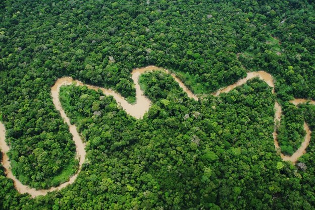
From the old-growth stands of British Columbia to biomass modelling in Brazil, LiDAR delivers unmatched accuracy, faster turnaround, and better ROI.
And that’s just the start—because when you see what LiDAR can do for stand delineation, biomass calculations, and growth modelling, it’s hard to imagine going back to the old way.
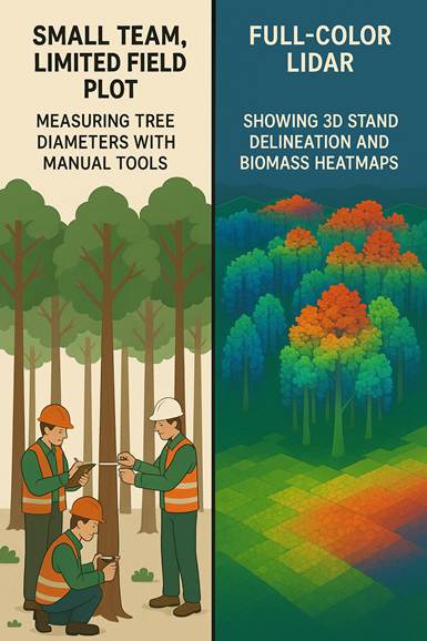
LiDAR vs. Traditional Field Plots
For decades, forestry inventory has relied on field plots, forestry crews measuring tree details in specific, small areas. It works, but it’s often slow, costly, and limited in scope.
The real issue? Sampling density.
The USDA’s Forest Inventory and Analysis (FIA) program uses a plot roughly once every 2,428 hectares of forest—meaning you’re making estimates for 99.99% of the forest, not actually mapping it.
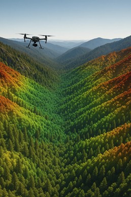
LiDAR flips that whole approach. It delivers complete forest coverage with centimetre-level accuracy, capturing every hectare with canopy structure, terrain, and biomass data.
Head-to-Head: Field Plots vs. LiDAR Mapping
| Feature | Field Plots | LiDAR Mapping |
| Coverage | Sparse (one plot per ~2,400 ha) | Full, wall-to-wall mapping |
| Accuracy | Variable, human-dependent | Consistent, high-resolution measurements |
| Speed | Weeks or months in the field | Days via airborne scanning |
| Accessibility | Limited in tough terrain | Feeds through canopy and rugged areas |
| Data Richness | Basic measurements | Full 3D point clouds, structure, volume |
“LiDAR’s ability to capture full coverage of a forest landscape removes the guesswork that field plots introduce.”
— Dr. Nicholas Coops, University of British Columbia
Why It Matters
With incomplete data, your planning risks being off, whether it’s yield estimates, boundary accuracy, or regulatory compliance. LiDAR fills the gaps, delivering comprehensive data you can rely on.
Let’s dive into how LiDAR enables stand delineation with surgical precision, helping you map forest stands more accurately than ever.
Stand Delineation with LiDAR
In forestry, knowing exactly where one stand ends and another begins is the foundation for accurate inventory, harvest scheduling, and sustainable planning. Get this wrong, and you risk mixing age classes, miscalculating yield, or damaging regeneration zones.
Traditional methods rely on field crews walking boundaries and interpreting aerial photos. It’s slow, subjective, and in dense forests, prone to error. Shadows, canopy overlap, and seasonal changes can distort aerial imagery, leading to misclassification.
LiDAR solves these problems by delivering objective, high-resolution 3D data of the forest canopy and terrain.
Using point clouds, millions of laser returns per square kilometre, LiDAR can detect subtle variations in canopy height, density, and structure that indicate stand boundaries. These datasets integrate seamlessly into GIS platforms like ArcGIS and QGIS, allowing planners to draw precise, data-backed stand polygons in hours instead of days.
Example in Action
A Canadian Forest Service study found that LiDAR-derived stand maps were up to 25% more accurate than those created with photo interpretation alone, especially in mixed-age and uneven terrain forests. This precision means better harvest block planning, reduced environmental impact, and stronger compliance with provincial and federal regulations.
Once you’ve got those stands accurately mapped, the next step is understanding what’s inside them, and that’s where LiDAR’s biomass calculation capabilities shine.
Growth Modelling and Future Planning with LiDAR
Forestry isn’t just about what’s standing now; it’s about what will be there in 5, 10, or 50 years. Growth modelling is the tool that turns inventory data into future scenarios you can actually plan around.
With traditional field methods, growth models often start with limited plot data, meaning projections are built on assumptions that may not reflect the full diversity of your forest. This can lead to underestimating yields, overestimating regeneration, or missing early signs of pest and disease spread.
LiDAR adds precision and scale to this process. By providing high-resolution baseline measurements, tree height, canopy structure, and stand density, LiDAR feeds growth models with real, wall-to-wall data instead of extrapolated averages. When paired with repeat LiDAR surveys, you can track actual growth rates over time, not just predicted ones.
Real-World Advantage
Here’s where LiDAR stops being “cool tech” and starts making you real money.
According to the Canadian Forest Service, LiDAR gives forest managers the ability to “monitor forest dynamics more efficiently.” That means you’re not just tracking trees, you’re tracking the factors that make or break your bottom line:
- Smarter harvest rotation decisions
- Better-targeted silviculture investments
- Stronger climate adaptation strategies that actually work in the field
This is a game-changer for high-value timber regions in British Columbia, where shifts in temperature and precipitation are already influencing growth rates. In other words, if you’re still making calls based on last year’s data (or worse, field plots from five years ago), you’re leaving serious money and sustainability on the table.
Seamless Integration with Forestry Management Systems
Collecting LiDAR data is only half the story. The real win is how easily it plugs into the systems you’re already using, turning raw point clouds into actionable plans without adding extra steps to your workflow.
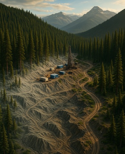
LiDAR outputs can be imported directly into GIS platforms like ArcGIS Pro or QGIS for mapping, spatial analysis, and reporting. It also integrates with CAD software for engineering and infrastructure planning, hydrology models for watershed management, and forestry-specific platforms for harvest block design and stand management.
Because LiDAR data is georeferenced and compatible with standard formats (LAS, LAZ, GeoTIFF), it can be layered with:
- Satellite imagery for change detection
- Aerial photography for visual context
- Forest inventory databases for integrated planning
- Hydrology and slope models to reduce environmental impact during harvest
Example: A forestry company in northern BC used LiDAR to update its entire stand inventory and feed that into its existing GIS database. Within days, planners could see harvest-ready areas, regeneration blocks, and high-risk zones for windthrow, all in one interface.
“The beauty of LiDAR is that it doesn’t require you to overhaul your tech stack—it just supercharges what you’re already using.”
— Eagle Mapping Technical Team
We’ll explore how LiDAR’s speed and scale give you a competitive edge, covering more ground, more accurately, in less time than traditional methods ever could.
Speed, Scale, and Cost Efficiency
In forestry, time is money, and so is precision. Every day spent gathering data in the field is a day you’re not making operational decisions. That’s why LiDAR is such a game-changer: it covers more ground, more accurately, in a fraction of the time.
NASA’s use of LiDAR after Hurricane Katrina: The team completed what traditionally would take months in just two days, showcasing LiDAR’s real-world speed and efficiency.
Here’s what that looks like in practice:
- Tens of thousands of hectares mapped in days by a LiDAR-equipped aircraft
- Fewer field visits, lowering labour costs and travel expenses
- Year-round operations—LiDAR penetrates bare or leaf-on canopies, so you don’t have to wait for the “perfect” season
- Reduced need for repeat surveys thanks to higher initial accuracy
Case in Point: In one BC project, LiDAR reduced the field data collection timeline from five weeks to six days, allowing the client to complete its environmental assessment and harvest plan well ahead of the regulatory deadline.
Next, we’ll bring it all together—summarizing why LiDAR has become the gold standard for forestry inventory mapping from BC to Brazil, and how its accuracy, speed, and integration make it the go-to choice for modern forestry operations.
Why Choose LiDAR?
From old-growth management in British Columbia to biomass assessments in the Amazon, LiDAR has proven one thing: it delivers the kind of accuracy and efficiency that traditional methods can’t match.
It’s not just about collecting data; it’s about collecting the right data.
- Stand delineation becomes precise, reducing over- or under-harvesting.
- Biomass calculations feed into accurate carbon accounting, unlocking real value in offset markets.
- Growth modelling informs smarter, long-term forest management decisions.
- Seamless integration with existing GIS, CAD, and forest management software ensures your data goes to work immediately.
- Speed and scale mean you get complete coverage in days, not weeks or months.
And the beauty is, this isn’t limited to one geography, forest type, or project scale. LiDAR’s flexibility makes it just as valuable for a small private woodlot in the Kootenays as it is for a national forestry program in South America.
With pressures mounting from climate change, carbon accounting requirements, and the need for sustainable harvests, forestry companies can’t afford to rely on outdated, sample-based methods. LiDAR isn’t the future of forestry mapping; it’s the present.