If you’re in charge of a development project, whether it’s forestry, mining, utilities, or municipal infrastructure, you already know the cost of bad data. Wrong elevations. Missed drainage paths. Inaccurate terrain models. Those mistakes? They’re expensive.
That’s where LiDAR mapping changes the game.
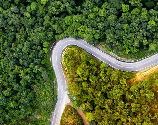
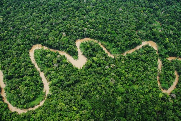
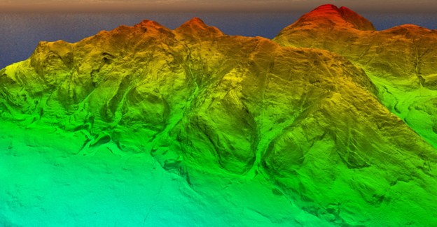
LiDAR (Light Detection and Ranging) gives you fast, high-accuracy elevation data, even through dense forests and rough terrain so that you can make smarter decisions from day one. No guesswork. No delays. Just clean, usable 3D models of the land you’re working with.
Forget boots-on-the-ground surveys that take weeks. LiDAR delivers millions of data points in a single flight, cutting survey time, reducing field costs, and giving you a clear edge when it comes to planning, permitting, and development.
The U.S. Geological Survey now relies on LiDAR to build the national elevation model, because it works.
And the best part? It’s not just for government agencies. Environmental consultants, engineers, and planners across North, Central, and South America are already using LiDAR to speed up approvals, reduce risk, and meet compliance standards with confidence.
What Is LiDAR Mapping?
Let’s keep this simple: LiDAR is how you get precise data about your land, fast.
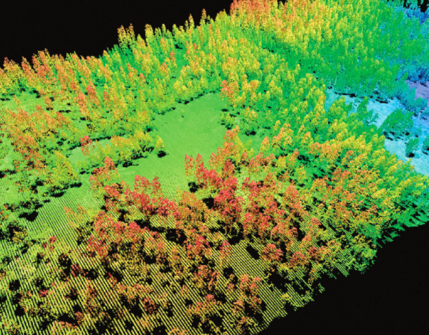
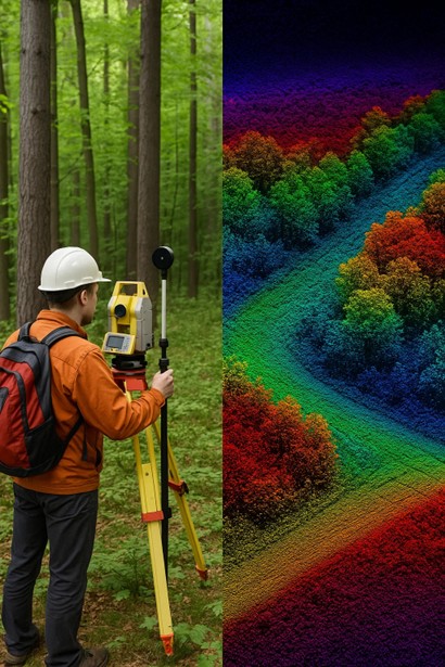
It stands for Light Detection and Ranging. It works by firing rapid laser pulses from a plane, drone, or truck to measure the shape of the land below. Each pulse bounces back, giving a pinpoint reading of what’s on the ground: elevation, vegetation, buildings, you name it.
The result? A high-resolution 3D map of your site with detail that ground surveys just can’t match. No waiting weeks. No climbing through brush. No wasted time.
Why It Works Better Than the “Old Way”
You could send a crew into the bush for two weeks to manually measure elevations. Or you could fly a LiDAR-equipped aircraft and have the entire area mapped in a few hours, with data accurate to within centimetres.
That kind of speed and precision means:
- You plan faster
- You permit faster
- You build smarter
- And you avoid costly surprises
LiDAR doesn’t care about trees, rough terrain, or tight deadlines. It just gets you the data you need to make real decisions.
“LiDAR has become the gold standard for topographic data collection, particularly for industries that can’t afford to guess.”
— Dr. Michael Olsen, Oregon State University
Two Types You Should Know
- Airborne LiDAR
Mounted to aircraft or drones. Best for large areas like forestry blocks, pipeline corridors, mining claims, and utility infrastructure.
➤ See how we do it → - Terrestrial LiDAR
Ground-based, used for construction sites, urban infrastructure, or close-range scans where detail matters.
Bottom Line?
LiDAR lets you see the full picture, not just what’s visible, but what’s hiding under the trees, slopes, and surface noise. That means no surprises when it’s time to dig, build, or submit reports.
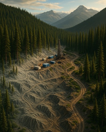
Why LiDAR Is a Game-Changer in Resource Development
If you’re developing land, LiDAR isn’t a luxury. It’s a necessity.
We’re talking about millimetre-accurate elevation data, delivered fast and at scale. It’s the tool serious professionals use to avoid delays, meet compliance, and protect margins.
Old-school methods? They miss details. They take time. And they cost you, whether it’s a blown budget, a delayed permit, or a field team stuck measuring tree stumps by hand.
Here’s what LiDAR gives you that traditional surveying doesn’t:
1. Speed That Pays for Itself
A single LiDAR flight can collect millions of data points in just hours. That’s full topographic coverage before your competition even finishes mobilizing their crew.
Faster planning
Quicker approvals
More projects delivered on schedule
According to ISCAN, LiDAR can cut field time by up to 60% compared to traditional survey methods, especially in complex or heavily forested terrain. That’s not just a tech upgrade. That’s real-world time and budget saved.
2. Pinpoint Accuracy
Want to know exactly where low spots, ridgelines, and drainage paths are before you start designing roads or infrastructure?
LiDAR captures elevation changes down to the centimetre. That’s critical if you’re working with sensitive terrain, tight regulations, or complex logistics.
3. Vegetation? Not a Problem.
Forests, brush, swampy wetlands, LiDAR sees through it all. It penetrates tree canopies to map the ground underneath. You’ll know what’s there, not just what it looks like from a satellite.
That means more accurate environmental reports, better road placement, and less wasted time on-site.
4. Data That Does More
If you’re worried about compatibility, don’t be. LiDAR data integrates directly into the platforms and software your team already relies on. No reinventing the wheel. No painful workarounds.
Here’s how it plugs in:
GIS Systems
LiDAR and GIS go hand in hand. You can drop point clouds or elevation models straight into tools like ArcGIS to:
- Map terrain and vegetation
- Delineate watersheds
- Analyze land use and elevation shifts
See how ArcGIS integrates LiDAR for forestry and land analysis
Expert overview: How to combine LiDAR and GIS
CAD Platforms
Need to move from survey to design? LiDAR point clouds are easily converted into contours, TINs, or surface models for CAD tools like AutoCAD Civil 3D or MicroStation.
- Road alignment
- Site grading
- Infrastructure design
LiDAR gives your engineers accurate terrain input from the start.
Hydrology and Flood Modelling
LiDAR-derived Digital Elevation Models (DEMs) are essential for water flow analysis, floodplain mapping, and drainage planning.
GIS + Hydrology: Why DEMs from LiDAR matter
Volume Calculations
Need to measure cut/fill volumes or stockpile capacity? LiDAR data gives you accurate 3D terrain models that can be used in:
- Earthworks
- Land development
- Mining and excavation analysis
Most geospatial tools include built-in volume measurement features using LiDAR data.
Forestry and Biomass Analysis
Foresters and environmental planners use LiDAR to estimate:
- Tree height
- Canopy density
- Biomass and carbon stock
🔗 Study: LiDAR-based approach for tree and plot-level biomass mapping
🔗 MDPI: Using airborne LiDAR to map forest canopy and biomass
Real-World Use Cases: How the Pros Are Using LiDAR Right Now
LiDAR isn’t just for academics or tech nerds. It’s being used every day by boots-on-the-ground professionals who need reliable data to plan, build, and deliver.
Here’s where it’s making the biggest impact:
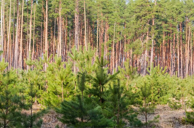
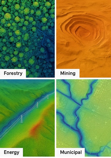
Forestry: Plan Smarter Harvests. Protect the Land.
Forestry consultants and logging companies use LiDAR to:
- Identify harvestable stands
- Analyze tree height, canopy density, and biomass
- Define accurate block boundaries and access roads
- Minimize environmental disruption
The result? Faster approvals and better yield. No wasted time scouting by foot. No guesswork in layout.
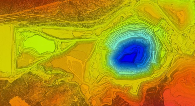
Mining: Know the Terrain Before You Break Ground
In mining, mistakes are expensive. With LiDAR, you get:
- High-resolution elevation models for pre-exploration
- Detailed terrain for haul road design
- Volumetric analysis for excavation and stockpiles
- Slope stability data for tailings ponds and dumps
It’s used from early prospecting to full-scale operations, because the land doesn’t lie when you map it properly.
Energy: Map Corridors Without the Headaches
Whether it’s pipelines, powerlines, or solar farms, LiDAR helps:
- Identify optimal routing with minimal environmental impact
- Assess elevation and slope in remote corridors
- Monitor vegetation encroachment post-installation
- Reduce time in the field, especially in rugged or inaccessible areas
You’ll get what you need to satisfy regulators, engineers, and stakeholders, without blowing your timeline.
Municipal Development: Upgrade Cities with Confidence
For municipalities, LiDAR supports:
- Infrastructure upgrades (roads, stormwater, utilities)
- Floodplain analysis and water flow modelling
- Smart city planning and 3D urban mapping
- Permit-ready data that passes the red tape test
Whether you’re working with a tight budget or high-growth demand, LiDAR helps stretch your dollars and future-proof your designs.
Why Working with a LiDAR Expert Matters
LiDAR data is only as good as the team collecting and processing it.
Yes, the tech is powerful. But if your provider can’t deliver clean, usable results that plug into your workflow without headaches, you’ve wasted your money.
That’s why working with a seasoned LiDAR partner like Eagle Mapping makes all the difference.
You Get Reliable, Decision-Ready Data
No guesswork. No formatting nightmares. No files you have to “clean up later.”
We give you accurate, fully processed elevation data, ready to use in:
- GIS
- CAD
- Planning reports
- Environmental assessments
- Engineering models
If it’s not usable by your team on Day One, we haven’t done our job.
Faster Turnarounds, Fewer Surprises
Because we’ve mapped everything from dense BC forests to South American mining corridors, we know how to:
- Mobilize quickly
- Handle complex terrain
- Navigate permitting and airspace regulations
- Deliver results on time and on budget
The result? Projects move forward faster. Delays disappear. Teams get what they need without chasing down missing files or incomplete coverage.
Custom Data Solutions
Your forestry plan isn’t the same as a powerline corridor or municipal upgrade. We treat it that way.
Eagle Mapping builds custom flight plans and deliverables to suit:
- Your timeline
- Your terrain
- Your compliance needs
- Your end-user applications
Because a generic LiDAR scan won’t cut it when you’re trying to impress regulators, win permits, or justify million-dollar decisions.
“Getting raw point cloud data is easy. Getting the right data, processed, validated, and mapped correctly? That’s what separates the pros from the pretenders.”
— Internal Project Manager, Eagle Mapping Client (2024)
You’re Supported by 40+ Years of Experience
Eagle Mapping isn’t new to this game. We’ve been at it for decades, long before LiDAR became a buzzword.
We’ve delivered mapping solutions across:
- Forestry
- Mining
- Hydro and utility projects
- Transportation and infrastructure
- Conservation and environmental impact planning
And we’ve done it across North, Central, and South America.
Ready to Map Smarter?
If you’re serious about resource development, forestry, mining, energy, or infrastructure, you can’t afford to work with outdated data or second-rate surveys.
LiDAR gives you the speed, accuracy, and insight to make better decisions, faster.
But tools don’t win projects; teams do.
And Eagle Mapping has been delivering high-precision LiDAR solutions for over 40 years across North, Central, and South America.
We know the terrain. We know the industries. We know how to get you the data you need, clean, accurate, and decision-ready.
Here’s What to Do Next:
👉 Explore our full range of LiDAR services – See exactly how we support better outcomes in your industry.
👉 Book a free consultation – Tell us about your project. We’ll show you how to get the most value from LiDAR without wasting time or budget.
You don’t need more data.
You need the right data, collected by a team that knows how to use it.
That’s Eagle Mapping.
Let’s map your next move.