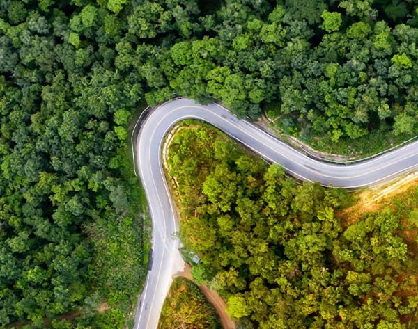
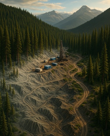
Conservation wins or loses on clarity. In South and Central America, the details that decide outcomes are hidden under dense canopy and spread across terrain that is hard to reach. LiDAR makes those details visible. It turns forests into precise, three-dimensional maps of ground and vegetation so you can spot risk early, plan with confidence, and measure real progress. For context, forest fragmentation is a major driver of biodiversity loss and ecosystem degradation globally, reinforcing why higher-fidelity data matters. (Nature)
Here is what you will get from this guide.
- Why accurate protected-area mapping is the cornerstone of biodiversity protection and park planning
- What LiDAR reveals that traditional surveys and standard imagery miss, including canopy structure, drainage, and early signs of encroachment
- Practical examples from Costa Rica, Peru, and Colombia that show LiDAR in action
- How to combine LiDAR with GIS and satellite data for continuous monitoring, enforcement, and restoration reporting
By the end, you will know exactly how to use LiDAR to prioritise critical zones, verify carbon and restoration results, and design corridors and infrastructure that protect habitat rather than fragment it. In short, you will have a clear path from data to decisions to measurable impact.
Work with Eagle Mapping on your next conservation-focused initiative.
Explore our LiDAR and mapping services.
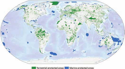
Why Mapping Protected Areas Matters
If your goal is real conservation impact, start with the map. Protected areas in South and Central America carry the weight of biodiversity, water security, and local livelihoods. The challenge is that the most important changes often happen out of sight under dense canopy or across hard-to-reach slopes.
Here is what accurate mapping unlocks.
- Targeted protection. See exactly where habitats are fragmented and where wildlife corridors will do the most good. In the Atlantic Forest, for example, 83–85 percent of surveyed sites showed losses in biomass and tree species richness, underscoring the stakes of getting corridor design right. (Nature)
- Faster enforcement. Detect early signs of illegal clearing, new access roads, or mining activity before they spread.
- Smarter infrastructure. Plan trails, ranger posts, and visitor access that avoid sensitive zones and erosion risks.
- Credible reporting. Measure carbon stocks, restoration progress, and watershed health with evidence that stands up to audit.
Traditional surveys are slow and limited to accessible ground. Satellite images give broad coverage but miss what lies beneath the canopy. To make confident decisions at speed, you need a tool that reveals both the forest and the terrain with precision.
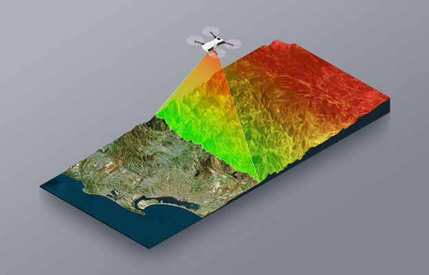
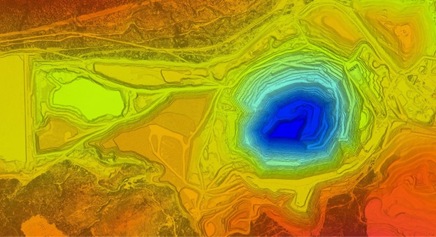
The LiDAR Advantage in Conservation Mapping
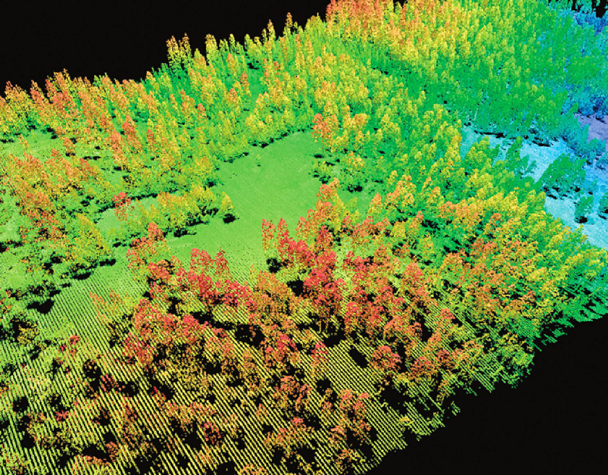
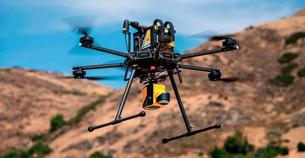
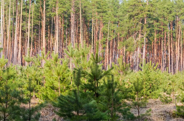
LiDAR gives you the clarity that standard methods miss. It sends pulses of light and returns a dense 3D point cloud that maps both vegetation and ground in fine detail. You get a truthful picture of the landscape, even under thick rainforest.
“LiDAR remote sensing is fit for the purpose of biodiversity assessment and monitoring through its ability to characterise vegetation structure in space.” — William D. Simonson, Methods in Ecology and Evolution. (BES Journals)
What LiDAR delivers for conservation teams.
- Forest structure and biomass. Quantify canopy height, stand density, and carbon distribution to prioritise high-value zones. Research shows LiDAR improves the accuracy of above-ground biomass estimates in tropical forests and even at tree level. (Panda)
- Change you can act on. Spot small clearings, informal roads, and slope cuts that signal encroachment or landslide risk.
- Restoration that works. Identify degraded areas, model replanting layouts, and verify regrowth against a precise baseline.
- Water and erosion intelligence. Map flow paths, floodplains, and unstable slopes to protect watersheds and communities.
- Better habitat models. Combine LiDAR with species data to predict where wildlife will thrive and where corridors will truly connect. A growing body of work documents LiDAR’s value for habitat modelling and species assessments. (PMC)
Ready to translate LiDAR insight into conservation outcomes. Explore Eagle Mapping’s LiDAR and mapping services.
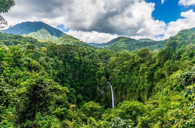
Costa Rica: Modeling Forest Canopies for Biodiversity
LiDAR in a Living Laboratory
Costa Rica is a proof point for conservation at scale. Within a compact footprint, it shelters more than half a million species and manages some of the most studied forests on Earth. Success here depends on understanding not only which species live where, but how their habitats actually work day to day. LiDAR delivers that clarity. Costa Rica’s Biological Corridors strategy, coordinated by SINAC, provides the national framework that LiDAR can strengthen. (SINAIC)
Mapping the Invisible Layers of the Forest
With centimetre-level precision, LiDAR models canopy height, structure, and density. That unlocks answers you cannot see from above the treetops. How light reaches the understory. Where water moves across slopes after heavy rain. Which ridgelines and valleys will connect habitats into effective wildlife corridors. Long-running LiDAR work at sites such as La Selva Biological Station shows how canopy height and carbon can be quantified over time to guide management.
Informing Smart Conservation Policy
When LiDAR outputs feed national GIS, policy moves from intention to implementation. Teams can target reforestation to the exact hectares that need it, measure progress over time, and plan trails or ranger posts that avoid sensitive zones. This evidence-based approach helps Costa Rica balance development and preservation while maintaining its leadership in clean energy.
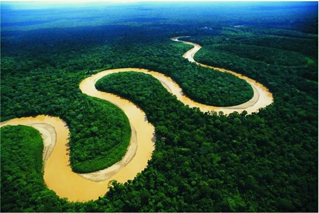
Peru: Monitoring Deforestation and Land Use Change
The Challenge of Scale
Peru holds the Amazon’s second-largest share. More than 68 million hectares of dense, often inaccessible rainforest make traditional surveys slow and incomplete. Satellites help, but small clearings, selective logging, and under-canopy activity often slip through.
How LiDAR Strengthens Environmental Oversight
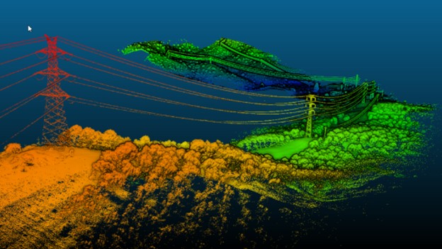
LiDAR closes that gap. Detailed digital elevation models and canopy height maps expose subtle land-use changes early. New access tracks. Slope cuts that signal erosion risk. Small clearings that can become large ones if left unchecked. Combined with optical imagery, LiDAR enables near real-time monitoring and faster enforcement so agencies can act before damage spreads. In Madre de Dios, LiDAR has been used to map high-resolution carbon stocks and emissions across millions of hectares, providing defensible baselines for management.
Supporting Carbon Accounting and Reforestation
Precision matters when money and credibility are on the line. For REDD+ and other climate programmes, LiDAR quantifies above-ground biomass, sets defensible baselines, and verifies carbon credits with confidence. Regions such as Madre de Dios use LiDAR to align conservation goals with investor expectations and public transparency.
Eagle Mapping delivers high-resolution LiDAR and terrain models that turn vast rainforests into actionable intelligence for ministries, NGOs, and research partners.
Learn how Eagle Mapping partners with environmental agencies and NGOs across the Americas. Explore our LiDAR and mapping services.
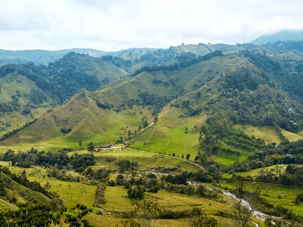
Colombia: Supporting Peace and Sustainable Land Management
Mapping for a New Era of Stability
Colombia is opening landscapes that were off-limits for decades. Now comes the hard work. Clarify land tenure. Rebuild critical infrastructure. Restore ecosystems that have been ignored for years. You cannot do any of that well without proof you trust. LiDAR gives you that proof. It converts rugged terrain and dense canopy into decision-ready data that moves projects forward.
Restoring Forests and Watersheds
You need to know where to act first. LiDAR models vegetation and terrain together so teams can pinpoint erosion-prone slopes, spot deforested corridors, and prioritise replanting where it will deliver the most ecological return. In the Sierra Nevada de Santa Marta and the Andes–Amazon transition zones, LiDAR reveals watershed patterns that guide land use, landslide prevention, and corridor design. Feed those layers into national GIS. Pair them with field checks. Policy turns into implementation you can measure.
Empowering Indigenous and Community Stewardship
Results stick when local stewards are equipped with evidence. High-resolution LiDAR maps of forest cover, rivers, and boundaries help indigenous and rural communities strengthen land claims, plan sustainable resource use, and demonstrate compliance with conservation goals. That builds long-term peace, protects livelihoods, and hardens environmental resilience.
Integrating LiDAR with GIS and Satellite Data for Ongoing Monitoring
A Unified View of the Landscape
LiDAR owns the detail. Add multispectral and hyperspectral satellite imagery, and you own the big picture too. Together these layers show topography, canopy height, vegetation health, soil moisture, and early deforestation signals. For project teams, that means a single, coherent view of ecosystem status and risk. (Nature)
From Data to Decision Making
Inside modern GIS, layers become action. Managers visualise change over time, quantify biomass loss, and forecast land-use shifts with machine learning. That means proactive management instead of chasing yesterday’s problems. Exactly what dynamic ecosystems in South and Central America demand.
Eagle Mapping’s End to End Capability
Acquisition is the start. Eagle Mapping processes, classifies, and integrates LiDAR into GIS-ready products that make it simple to track change, model habitats, and report conservation performance with confidence. By uniting LiDAR, GIS, and satellite imagery, we help governments, NGOs, and research organisations keep a constant, evidence-based pulse on protected areas.
Turn your conservation goals into measurable action.
Learn more about Eagle Mapping’s LiDAR and geospatial services.
Mapping a Future Worth Protecting
Conservation wins with proof, not promises. LiDAR gives you proof. It shows what is happening under the canopy, where risk is building, and where action will pay off. In Costa Rica, Peru, and Colombia, teams are using LiDAR to prioritise corridors, target reforestation, and back every decision with evidence. And the broader science is clear: degradation and fragmentation are major drivers of tropical biodiversity and carbon loss, so monitoring with precision is non-negotiable.
If you cannot measure it, you cannot manage it. LiDAR lets you do both. You get precise baselines. You track change over time. You validate impact for funders, governments, and communities. That is how you secure support, keep projects moving, and protect more land with fewer mistakes.
Want results you can defend? Put LiDAR at the centre of your plan. Use it to find the critical hectares, prevent costly errors, and prove outcomes with clarity.
Eagle Mapping makes this simple. We capture high-resolution LiDAR, process it into clean, GIS-ready products, and deliver the decision tools your team needs to act fast and report with confidence.
Work with Eagle Mapping on your next conservation-focused initiative.
Explore our LiDAR and mapping services and turn precision data into real environmental impact.