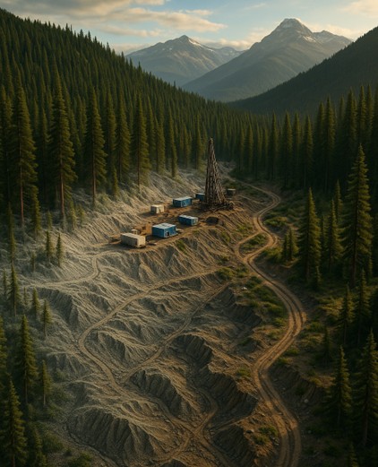
In an age when decision cycles are compressed and margins are tight, choosing the wrong mapping method can cost you more than just money; it can derail a project. Whether you’re working in rugged mountain terrain, dense forest, or tight-urban corridors, you need the right tool for the job.
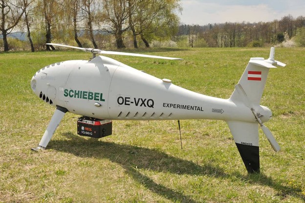
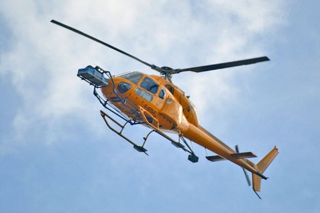
That’s why understanding the trade-offs between Aerial LiDAR (fixed-wing or helicopter platforms) and Drone (UAS) LiDAR is crucial. Each has strengths, limitations, costs, and ideal use cases. Use the wrong platform, and you might end up with sub-par resolution, too long timelines, or inflated costs.
Here’s the reality:
- Fixed-wing aerial LiDAR can cover tens of thousands of hectares in a single campaign, delivering large-scale topography and region-wide continuity (Natural Resources Canada’s Federal Airborne LiDAR Data Acquisition Guideline).
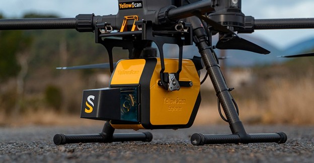
- Drone LiDAR can deliver very high point density over smaller areas, enabling detailed mapping of steeper slopes, local infrastructure, or sites needing frequent revisit.
And the landscape is changing. Transport Canada’s 2025 drone regulation updates are expanding Beyond Visual Line of Sight (BVLOS) privileges and easing restrictions for medium drones in advanced operations, making drone LiDAR viable for projects that until recently seemed only feasible by aircraft (Transport Canada).
The bottom line? Both platforms can produce excellent results, but your choice will depend on terrain, scale, logistics, and timeline.
To see how Eagle Mapping uses both aerial and drone LiDAR in practice, explore our LiDAR Services for Exploration and Development. We will break down the core technical and logistical differences between Aerial and Drone LiDAR, so you can see exactly where each shines.
TL;DR: When to Use Aerial vs. Drone LiDAR
If you just need the short answer, here it is:
Use Aerial LiDAR when you need:
- Large areas mapped quickly. Think corridors, watersheds, or multi-township projects.
- Consistent, uniform data across a big footprint.
- Coverage of hard-to-access terrain with minimal on-the-ground presence.
Use Drone LiDAR when you need:
- Local-scale detail for mine sites, steep slopes, or infrastructure.
- Ultra-high point density and flexibility for complex terrain.
- Rapid re-flights for change detection or post-event checks.
Both platforms can deliver survey-grade accuracy. The difference is scale, logistics, and speed. According to the U.S. Geological Survey, LiDAR surveys can reduce mapping timelines by up to 60% compared to traditional ground-based methods. How you achieve that efficiency depends on whether you fly high (aircraft) or low (drones).
Want to compare deliverables across platforms? See Eagle Mapping’s full range of LiDAR services.
How the Platforms Differ
Here’s what separates aerial LiDAR from drone LiDAR in practice:
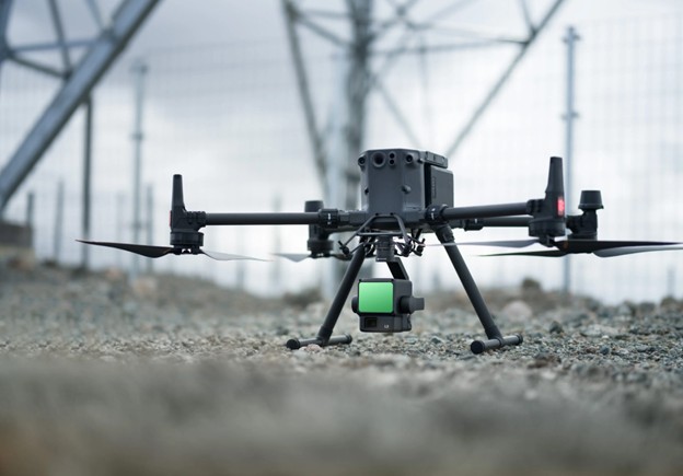
- Sensor & Platform: Aerial LiDAR sensors are mounted on fixed-wing aircraft or helicopters, flying at higher altitudes. Drone LiDAR sensors are mounted on multirotor or fixed-wing UAS flying much lower.
- Coverage & Scale: Aircraft can map hundreds of square kilometres per day, making them ideal for regional-scale projects. Drones are better for smaller, detailed areas, typically a few square kilometres at a time.
- Altitude & Swath: Higher altitude means a wider swath per flight line for aircraft. Drones, flying lower, capture narrower swaths but with higher point density.
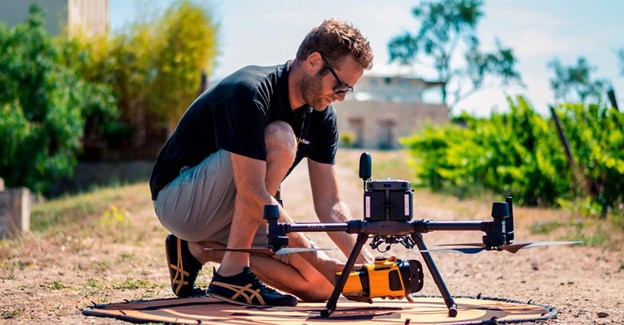
- Mobilization & Logistics: Aircraft require hangar time, coordination, and sometimes special airspace clearance. Drones can be deployed quickly on-site, provided you’re operating within Transport Canada drone regulations (Transport Canada).
- Airspace & Permissions: Aircraft operate in regulated airspace, but flight planning is routine. Drone LiDAR may face restrictions in urban or controlled airspace, requiring Special Flight Operations Certificates (SFOCs) for Beyond Visual Line of Sight (BVLOS) operations in Canada.
- Accuracy & Data Quality: Both can achieve centimetre-level accuracy when combined with high-quality GNSS/IMU systems and proper ground control. The difference comes down to project needs; do you need regional consistency or ultra-local detail?
As Natural Resources Canada notes in its Federal Airborne LiDAR Guideline, planning and quality control matter more than platform choice: flight design, overlap, ground control, and QA workflows determine accuracy and usability.
Aerial LiDAR is your broad brush. Drone LiDAR is your fine-tipped pen. Most projects benefit from one or sometimes a combination of both.
Data Quality & Deliverables (What You Actually Get)
No matter which platform you choose, the end goal is the same: usable, decision-ready data that plugs straight into your workflows. Both aerial and drone LiDAR can deliver:
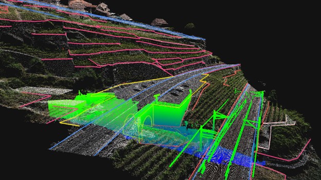
- Classified point clouds (ground, vegetation, structures)
- Digital Elevation Models (DEMs) and Digital Surface Models (DSMs)
- Contours and slope models
- Intensity images and, if combined with cameras, orthophotos
- Hydro breaklines for drainage and flood modelling
The quality of the data depends less on the platform and more on the process: calibration, flight planning, overlap, GNSS/IMU performance, and ground control. As Natural Resources Canada emphasizes in its Federal LiDAR Guideline, workflow and QA standards are what deliver accuracy, not just the hardware.
And when it comes to accuracy, the numbers speak for themselves. A 2020 study published in Remote Sensing (MDPI) found that drone-based LiDAR achieved vertical accuracies within 5–10 cm, provided proper quality control was in place (MDPI Remote Sensing). Similar performance is possible with aerial LiDAR, though typically optimized for larger areas rather than fine-scale sites.
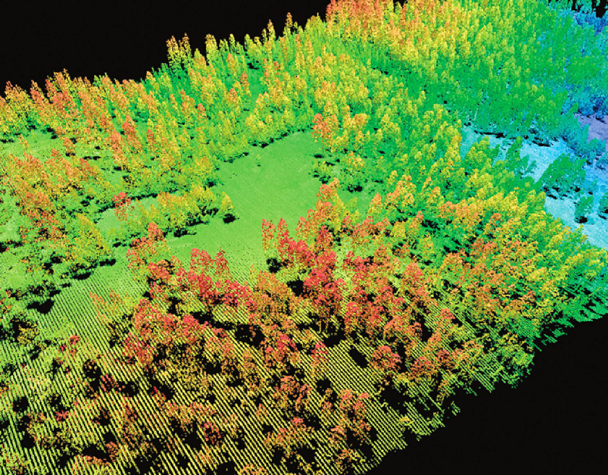
Vegetation is where LiDAR truly outshines other mapping methods. Unlike photogrammetry or satellite imagery, LiDAR pulses can penetrate canopy gaps to create bare-earth models.
Aerial or LiDAR?
When Aerial LiDAR Wins (Fixed-Wing & Helicopter)
If your project footprint is big, aerial LiDAR is usually the winner. Flying higher and wider means you get regional-scale coverage in fewer flight hours, a major advantage when deadlines are tight.
Here’s when aerial LiDAR is the right choice:
- Regional coverage: transmission lines, pipelines, watersheds, forestry inventories.
- Large-scale consistency: uniform data specifications across hundreds of square kilometres.
- Tight schedules: big areas mapped in a fraction of the time it would take drones.
- Minimal on-site presence: perfect for sensitive or hard-to-access terrain where ground crews are limited.
The U.S. Geological Survey highlights aerial LiDAR as one of the most effective methods for mapping large, forested or glaciated regions, where traditional surveys struggle.
“Airborne LiDAR has revolutionized the scale and speed at which we can capture high-resolution topography, even in dense vegetation.”
— Dr. Michael Olsen, Oregon State University
Example: In a forestry project spanning tens of thousands of hectares in British Columbia, aerial LiDAR was able to capture a complete bare-earth model in just a few days of flying. A drone-based approach would have taken weeks, costing significantly more in labour and logistics.
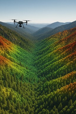
When Drone LiDAR Wins (UAS Platforms)
Drone LiDAR shines when the footprint is smaller, the details matter, or you need speed and flexibility on site. Operating at lower altitudes, drones capture extremely dense data that aircraft can’t match at scale.
Here’s where drones are your best bet:
- Site-scale precision: mine pads, haul roads, retaining walls, or stockpiles.
- Change detection: re-fly after a blast, flood, or construction milestone to spot differences quickly.
- Complex terrain: steep slopes, narrow corridors, or confined spaces where high-density data makes all the difference.
- Rapid mobilization: small teams can deploy within hours, perfect for tight project windows.
Example: A mining client in northern BC used drone LiDAR to validate haul road alignments in rugged terrain. By capturing high-density elevation models around planned road tie-ins, the engineering team avoided costly rework and saved weeks of redesign.
Cost, Schedule & Logistics
At the end of the day, your choice may come down to dollars and days. Here’s the rule of thumb:
- Aerial LiDAR is more cost-effective for large footprints. The economies of scale kick in when you need regional coverage.
- Drone LiDAR is better for smaller sites or frequent re-surveys, where mobilization speed outweighs swath width.
Consider the logistics too:
- Aircraft require hangars, fuel, and flight planning, but cover vast areas quickly.
- Drones need launch/landing zones, batteries, and certified operators, plus compliance with Transport Canada’s drone regulations.
- Weather matters: drones are more sensitive to wind and rain; aircraft handle adverse conditions better but face icing/cloud ceiling limits.
According to Natural Resources Canada, careful planning around seasonality (leaf-on vs. leaf-off, snow cover, flood cycles) is critical for both aerial and drone surveys.
The best choice often isn’t one or the other; it’s a hybrid. See how Eagle Mapping builds custom aerial + drone survey packages: https://eaglemapping.com/services/
Accuracy, Density & Vegetation
Both aerial and drone LiDAR can achieve centimetre-level accuracy, but how they get there is different.
- Aerial LiDAR: Flying higher means fewer points per square metre, but with careful planning (flight overlap, GNSS/IMU quality, ground control), you can still achieve vertical accuracies within 10–15 cm across huge regions.
- Drone LiDAR: Flying lower enables very high point density (often hundreds of points per m²), capturing fine-scale terrain like slopes, benches, or vegetation gaps.
The real difference comes with vegetation. LiDAR’s laser pulses penetrate through canopy gaps to the ground, creating bare-earth models that imagery and photogrammetry can’t deliver.
“LiDAR remains the gold standard for capturing ground elevation beneath dense canopy, outperforming all other remote sensing technologies.”
— Natural Resources Canada (NRCan Remote Sensing Overview)
Whether you need regional accuracy or hyper-local density, Eagle Mapping tunes flight planning and classification workflows to match your project’s specs.
Integration With Your Workflows (GIS, CAD, Models)
LiDAR data is only valuable if it fits into your existing systems. That’s why every deliverable, whether from aircraft or drone, must be packaged to drop seamlessly into your tools.
At Eagle Mapping, we deliver LiDAR in formats compatible with:
- ArcGIS and QGIS for GIS workflows
- AutoCAD Civil 3D and MicroStation for design and engineering
- Hydrology and slope models for floodplain and drainage analysis
- Forest inventory databases for biomass, canopy density, and growth modelling
The Canadian Forest Service highlights LiDAR as a cornerstone in enhanced forest inventory systems, where point clouds and DEMs support advanced growth modelling and resource planning.
Whether it’s mining, municipal planning, forestry, or energy, LiDAR data isn’t just numbers, it’s actionable intelligence once integrated into your decision-making systems.
Safety & Regulatory Considerations
LiDAR mapping doesn’t happen in a vacuum; it happens in regulated airspace, often near communities or sensitive environments. That means safety and compliance are non-negotiable.
For aerial LiDAR (fixed-wing/heli):
- Flights are coordinated through civil aviation authorities and follow strict air traffic protocols.
- Because flights are at higher altitudes, the impact on wildlife, communities, and on-site crews is minimal.
- Pilots and operators are licensed, insured, and trained for specialized survey operations.
For drone LiDAR (UAS):
- Operations in Canada fall under Transport Canada’s drone regulations.
- Basic and Advanced certifications apply depending on the airspace. For Beyond Visual Line of Sight (BVLOS) operations, a Special Flight Operations Certificate (SFOC) may be required.
- Drones must be operated by certified pilots with clear safety protocols for launch zones, exclusion areas, and public notification.
- Weather windows are more limited; wind, rain, or fog can ground UAS operations.
According to Natural Resources Canada, integrating LiDAR into national mapping programs has demanded “rigorous data quality and operational safety standards” to maintain consistency across diverse terrains and jurisdictions.
Bottom line: if you want usable data and no regulatory headaches, work with a team that knows how to navigate permits, permissions, and compliance across both platforms.
Real-World Scenarios (Where Each Platform Wins)
It’s one thing to compare specs; it’s another to see how this plays out in real projects. Here are four scenarios that show the difference:
Scenario A – Regional Corridor (Aerial LiDAR wins)
A transmission upgrade stretched across 150 km of mixed terrain in BC. With fixed-wing LiDAR, the entire corridor was mapped in just a few flight days. A drone-only approach would have taken weeks, delaying engineering deliverables and inflating costs.
Scenario B – Mine Site Re-Design (Drone LiDAR wins)
A mining company needed to relocate drill pads and haul roads on steep slopes. Drone LiDAR delivered ultra-dense terrain models of the target site, enabling safe pad placement and precise cut/fill analysis. This prevented rework that could have cost more than the drone survey itself.
Scenario C – Municipal Drainage Upgrade (Hybrid approach)
A western Canadian city needed updated drainage models for flood risk management. Eagle Mapping used aerial LiDAR to create a basin-wide baseline DEM, then deployed drone LiDAR to re-survey high-risk corridors after major storm events. The combination reduced costs and improved responsiveness.
Scenario D – Forestry Block Audits (Drone LiDAR efficiency)
Forestry managers used drone LiDAR to monitor post-harvest conditions on specific cutblocks. Instead of re-flying the whole landscape, drones captured detailed local updates, integrating into their Enhanced Forest Inventory systems for growth and yield modelling.
These aren’t hypotheticals; they’re examples of how choosing the right LiDAR platform can shave weeks off schedules, reduce costs, and lower risk.
Decision Guide : Choosing the Right Platform
If you’re still torn between aerial and drone LiDAR, here’s a quick checklist to cut through the noise:
How big is your area?
– Regional or multi-township? → Aerial LiDAR.
– Single site or a few square kilometres? → Drone LiDAR.
What’s your deadline?
– Need it in days? → Aircraft.
– Need a quick re-fly or spot check? → Drone.
What’s the terrain like?
– Dense forest or rugged mountains? → Aerial LiDAR for broad coverage.
– Steep slopes, retaining walls, or complex sites? → Drone LiDAR for density.
What deliverables do you need?
– Regional DEMs, hydrology models, or infrastructure corridors? → Aircraft.
– Engineering-grade surfaces, stockpile volumes, or cut/fill? → Drone.
Any regulatory or access challenges?
– Remote, inaccessible areas → Aircraft minimizes ground presence.
– Controlled airspace or urban settings → Drones can operate with permits under Transport Canada’s regulations.
Not sure which way to go? Eagle Mapping builds hybrid survey plans, aircraft for the baseline, drones for local detail, so you never have to compromise.
Common Myths & Pitfalls
Let’s bust a few myths that often confuse clients:
- “Drones are always cheaper.”
Not true. For large areas, aircraft surveys are more cost-effective. Drones excel in small, high-density sites. - “Aircraft can’t get enough detail.”
Modern aerial LiDAR systems, when flown at low altitudes with proper overlap, deliver extremely dense point clouds across massive areas. - “The platform decides accuracy.”
Accuracy comes from workflow and quality control—GNSS/IMU calibration, ground control, classification, and QA. Platform just determines logistics. - “Any point cloud is good enough.”
Wrong. Without classification, QA reports, and integration into your GIS/CAD workflows, raw point clouds are just noise.
According to Natural Resources Canada’s Federal Airborne LiDAR Guideline, clear specs and QA documentation are what turn laser returns into usable, defensible data.
Avoid these pitfalls by working with a partner that has decades of LiDAR experience. Eagle Mapping has been delivering decision-ready LiDAR across the Americas for 35+ years: https://eaglemapping.com/services/
Choose With Confidence
At the end of the day, both aerial and drone LiDAR deliver accurate, actionable data. The right choice comes down to scale, logistics, and the outcomes you need.
- Aerial LiDAR is your go-to for regional coverage, consistency, and speed.
- Drone LiDAR shines for site-scale precision, flexibility, and rapid re-flights.
- And often, a hybrid approach delivers the best of both worlds.
Are you ready to compare aerial and drone LiDAR for your project? See how Eagle Mapping delivers decision-ready data tailored to your industry at https://eaglemapping.com/services/.