In mineral exploration, every dollar carries weight. Investors expect results. Timelines are tight. And every decision, from staking claims to collaring the first drill, carries risk.
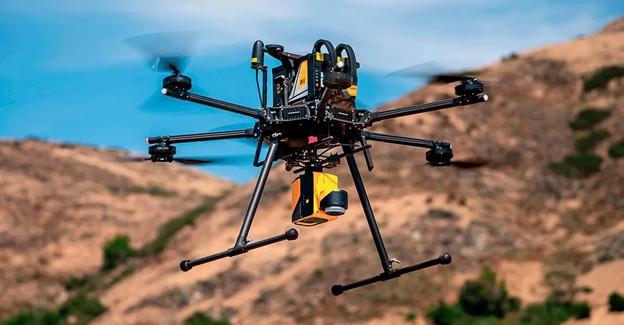
The challenge is clear: exploration teams are asked to do more with less, while operating in some of the harshest, most inaccessible terrain on the planet. That’s why leading explorers are turning to LiDAR (Light Detection and Ranging) as a way to reduce uncertainty, streamline planning, and maximize ROI.
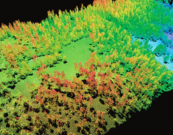
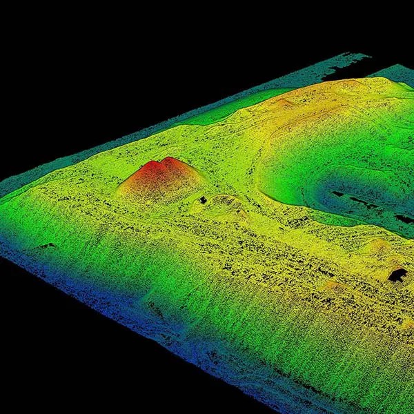
Unlike traditional mapping methods that struggle with canopy cover, rugged terrain, or incomplete datasets, LiDAR delivers high-resolution, bare-earth surface models that cut through the noise. With millions of laser returns, you see faults, folds, paleochannels, and even remnants of historic activity, details that are often invisible from the air or overlooked on the ground.
And this isn’t just theory. A USGS report notes that LiDAR technology provides a “reliable, repeatable method for capturing precise elevation data”, allowing geologists to identify subtle surface features critical to mineral exploration.
“LiDAR has become one of the most effective ways to uncover hidden geology in forested or glaciated regions, where traditional methods fall short.”
— Dr. Nicholas Coops, Faculty of Forestry, University of British Columbia
The result? A faster, clearer, and more cost-effective way to evaluate your claims before boots hit the ground.
Bare-Earth Insights Before Boots on the Ground
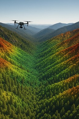
Before you send a single crew member into the field, LiDAR can already show you the features that define a property’s potential. This is where the technology shines: by generating detailed bare-earth models, LiDAR removes canopy and vegetation to reveal the subtle but critical landforms that drive exploration success.
Think faults and folds. Paleochannels. Glacial formations. Even signs of historic activity like trenches, pits, trails, and remnant access roads. All of these can be hidden from traditional aerial imagery or overlooked by ground crews with limited visibility.
LiDAR makes them visible, in high resolution, before your team spends a dollar on boots-on-the-ground reconnaissance.
The USGS notes that LiDAR-derived digital elevation models (DEMs) are often the most effective way to identify subtle surface features, especially in forested or heavily vegetated terrain. For explorers, that means you can:
- Avoid wasting time on inaccessible terrain
- Reduce line-cutting costs by knowing where to target
- Spot potential drill sites or hazards early
- Minimize field missteps that derail budgets and timelines
“With LiDAR, explorers can reduce risk in the earliest phases of a project, when each decision carries the highest uncertainty.”
— Eagle Mapping Technical Team
And the cost savings add up quickly. As one client in British Columbia noted, the investment in airborne LiDAR was less than the price of a single misplaced drill hole, a mistake that could have cost weeks of work and hundreds of thousands of dollars.
Curious how this applies to your project? Explore our LiDAR expertise to see how Eagle Mapping helps explorers cut costs and gain clarity before they set foot on site.
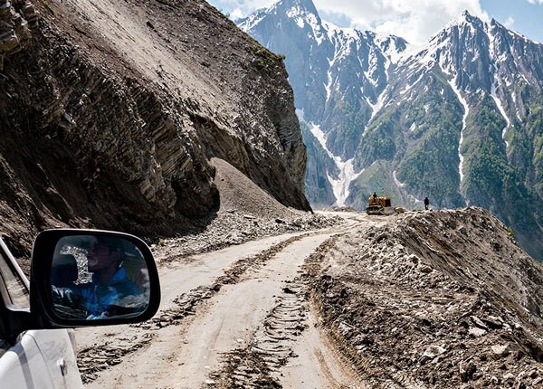
Smarter Drilling, Safer Logistics
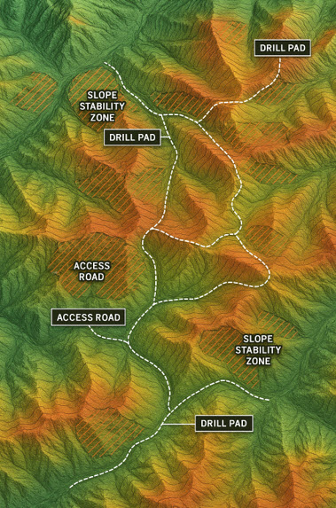
As an exploration program matures, the stakes get higher. The cost of drilling is significant, and logistics can make or break your budget. LiDAR plays a critical role here by providing the elevation and slope data you need to design safe, efficient, and cost-effective operations.
Accurate terrain models from LiDAR support:
- Drill pad placement that accounts for slope, stability, and access
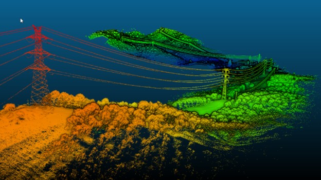
- Road and powerline routing in rugged terrain, reducing construction costs
- Camp layout planning that avoids wetlands and unstable areas
- Integration with geophysics and orthophotos to align all your spatial data in one view
The Canadian Forest Service highlights how LiDAR-derived DEMs allow for terrain analysis at a scale unmatched by traditional surveys. For exploration teams, that means fewer relocations, safer infrastructure placement, and faster approvals.
Case Example: In a northern BC project, LiDAR data guided the placement of drill pads and access roads. By avoiding steep slopes and unstable soils, the client cut road construction costs by nearly 20% and reduced exploration downtime due to terrain-based surprises.
And when exploration windows are short, whether due to weather, permitting, or seasonal access, that efficiency can be the difference between delivering results or missing your targets.
Learn more about how Eagle Mapping helps teams plan smarter drill programs.
Accelerating Permits and Building Trust
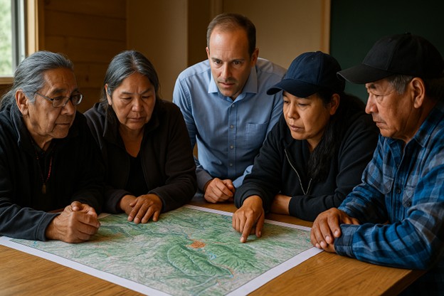
Exploration isn’t just about geology. It’s also about navigating the regulatory landscape and building trust with communities. A single permitting delay can cost weeks or months, while missteps with local or Indigenous stakeholders can create setbacks that are even harder to recover from.
This is where LiDAR delivers value beyond the technical. High-resolution elevation models help identify wetlands, culturally significant areas, and ecologically sensitive zones long before boots touch the ground. By visualizing these features early, companies can adjust their plans, demonstrate responsibility, and reduce the risk of redesigns or regulatory pushback.
According to Natural Resources Canada, LiDAR is increasingly used for wetland mapping, floodplain analysis, and habitat assessment, datasets that directly support environmental impact studies and compliance reporting.
For Indigenous engagement, the benefit is equally clear. Sharing detailed 3D terrain models builds transparency and shows that you’re committed to minimizing impact. This not only fosters stronger dialogue but also supports meaningful consultation, a requirement under Canadian law.
Case Example: In a BC exploration program, Eagle Mapping’s LiDAR data highlighted sensitive riparian zones before crews mobilized. By rerouting access trails early, the client avoided costly environmental mitigation measures and secured permitting three weeks faster than originally expected.
The Long-Term Payoff. LiDAR as a Project Asset
LiDAR isn’t just a tool for early exploration; it’s a long-term asset that keeps paying dividends throughout the mine lifecycle. From discovery to closure, that same dataset becomes a trusted reference point for planning, monitoring, and compliance.
Because LiDAR is time-stamped and repeatable, it creates a permanent digital record of the land surface. This data can be used for:
- Terrain stability assessments before infrastructure development
- Drainage and hydrology modelling to reduce flooding or erosion risk
- Vegetation change detection for reclamation monitoring
- Mine closure and rehabilitation reporting, where accurate “before-and-after” comparisons are essential
The key takeaway: what starts as an exploration tool becomes a compliance and risk management asset for the life of the mine.
See how Eagle Mapping provides decision-ready LiDAR data for every stage of a project lifecycle.
The ROI Case. Why LiDAR Pays for Itself
Every exploration team faces the same question: Is the investment worth it? With LiDAR, the answer is almost always yes, because the cost of airborne data collection is small compared to the risks and expenses it helps avoid.
Consider this:
- A misplaced drill hole can cost $50,000 to $100,000 or more in wasted work.
- A week of inefficient fieldwork in remote terrain can burn through tens of thousands in labour, camp, and fuel.
- A permitting delay can hold up millions in investment.
LiDAR helps you sidestep those risks. For most exploration teams, the price of a LiDAR survey is less than a single major misstep.
The USGS has highlighted LiDAR’s role in reducing survey timelines by as much as 60%, particularly in challenging environments. That translates into not just cost savings, but a faster path from exploration to results.
Case Example: In northern BC, Eagle Mapping’s LiDAR survey revealed terrain challenges that would have forced a costly road relocation mid-project. By rerouting early, the client avoided construction delays and saved more than $250,000 in direct costs.
When you add up the time saved, the risks avoided, and the smarter decisions made, LiDAR isn’t an expense, it’s a multiplier.
A Clearer Path Forward
Mineral exploration has always been a high-risk business. Every dollar counts, every decision carries weight, and the pressure to deliver results is constant. In that environment, the difference between success and costly mistakes often comes down to data quality.
That’s why LiDAR has become the gold standard for exploration. From bare-earth mapping before boots hit the ground, to smarter drilling logistics, to faster permitting and long-term compliance, LiDAR delivers clarity at every stage of the mining lifecycle.
- It reveals what traditional imagery and ground crews miss.
- It reduces costly missteps and shortens timelines.
- It supports transparent engagement and builds regulatory trust.
- And it pays for itself by avoiding mistakes that can sink budgets and delay projects.
As the Canadian Forest Service notes, LiDAR is now a cornerstone in how natural resources are mapped and managed. For exploration companies, that translates into better decisions, lower risk, and stronger returns.
At the end of the day, LiDAR isn’t just a mapping tool; it’s an investment in clarity, efficiency, and risk reduction. And in a sector where a single wrong move can cost millions, that investment quickly proves its value.
Discover how Eagle Mapping supports explorers across the Americas.